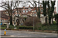
Area Overview for HP13 6EN
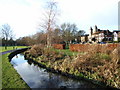
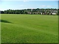
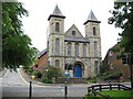
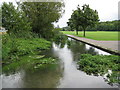
Photos of HP13 6EN


Area Information
Living in HP13 6EN means inhabiting a compact, residential postcode area with a population of 2,550 people spread across a densely populated landscape of 2,394 people per square kilometre. This small cluster of homes is defined by its proximity to key services and transport links, making it a practical choice for those seeking a balance between urban convenience and a quieter, community-focused environment. The area’s character is shaped by its mix of local amenities, including nearby schools, retail outlets, and rail connections. While it lacks sprawling green spaces, its accessibility to High Wycombe and Marlow railway stations ensures easy travel to larger towns and cities. Daily life here revolves around the immediate neighbourhood, with residents benefiting from a network of nearby shops, including Iceland High and Lidl London, and the presence of a small airport at Wycombe Air Park. The area’s demographic profile—skewed toward adults aged 30–64—suggests a mature, stable community, though the high population density may influence the pace of life. For buyers, HP13 6EN offers a focused, self-contained living environment with clear advantages in connectivity and local infrastructure.
- Area Type
- Postcode
- Area Size
- Not available
- Population
- 2550
- Population Density
- 2394 people/km²
The property market in HP13 6EN is defined by its high concentration of flats, with 53% of homes owned by residents rather than rented. This suggests a mix of owner-occupied and rental properties, though the data does not specify rental rates. The prevalence of flats indicates a housing stock tailored to smaller households or those prioritising ease of maintenance over larger properties. Given the area’s small size and high density, property choices are limited to this format, which may appeal to buyers seeking simplicity or those renting in a compact, well-serviced environment. The 53% home ownership rate implies that nearly half of properties are likely in the rental market, potentially attracting younger professionals or families requiring flexibility. For buyers, the challenge lies in the limited variety of housing types, but the proximity to transport and amenities may offset this. The area’s compact nature means that immediate surroundings, such as nearby towns, could offer more diverse options for those seeking alternative property types.
House Prices in HP13 6EN
No properties found in this postcode.
Energy Efficiency in HP13 6EN
The lifestyle in HP13 6EN is shaped by its proximity to essential amenities, including retail outlets like Iceland High, Lidl London, and Tesco High, which provide daily shopping convenience. The area’s rail links to High Wycombe, Bourne End, and Marlow offer easy access to larger towns for leisure, dining, or cultural activities. While the immediate vicinity lacks expansive parks or recreational spaces, the nearby Wycombe Air Park adds a unique dimension for aviation enthusiasts. The compact nature of the area means that most amenities are within practical walking or driving distance, fostering a sense of community. Residents benefit from a balance of local services and regional connectivity, allowing them to enjoy both the simplicity of a small postcode area and the opportunities of nearby towns. The mix of retail, transport, and niche facilities like the air park contributes to a lifestyle that prioritises accessibility and practicality.
Amenities
Schools
Residents of HP13 6EN have access to a range of educational institutions, including Bowerdean Nursery School, which provides early-years education, and two independent schools: Crown House School and The Chalfonts Independent Grammar School. Both independent schools hold a ‘good’ Ofsted rating, indicating a commitment to quality education. The presence of nursery provision alongside independent options offers families flexibility, whether they seek state-funded early education or private schooling. Independent schools often cater to specific educational philosophies or academic pathways, which may appeal to parents prioritising tailored learning environments. However, the absence of state secondary schools in the immediate area means families may need to consider commuting to nearby towns for comprehensive schooling. The mix of school types reflects HP13 6EN’s role as a residential hub with access to both local and specialist educational resources.
| Rank | School | Type | Entry gender | Ages |
|---|
Explore more schools in this area
Go to Schools tabDemographics
The community in HP13 6EN is predominantly composed of adults aged 30–64, with a median age of 47. This suggests a mature population, likely with established careers and family commitments. Home ownership stands at 53%, indicating a mix of owner-occupied and rental properties, though the accommodation type is overwhelmingly flats. This housing stock reflects a preference for smaller, managed living spaces, possibly catering to those prioritising convenience over larger homes. The predominant ethnic group is White, with no specific data on other demographics provided. The age profile and home ownership figures imply a community that is relatively stable, with fewer young families or elderly residents compared to other areas. While deprivation data is not explicitly stated, the high population density and reliance on flats may influence local quality of life, potentially affecting access to private outdoor space or larger homes. The area’s character is shaped by its residents’ life stages, with a focus on practicality and proximity to services.
Household Size
Accommodation Type
Tenure
Ethnic Group
Religion
Household Composition
Age
Household Deprivation
NS-SEC
Explore more demographic insights in this area
Go to Demographics tabPlanning
Planning Constraints
- Flood RiskPremium
- Ramsar Wetland SitesPremium
- Area of Outstanding Natural BeautyPremium
- Protected Nature ReservePremium
- Protected WoodlandPremium