Area Overview for HP13 6DR
Photos of HP13 6DR
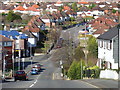
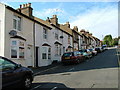
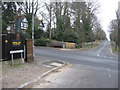
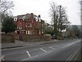
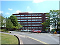
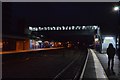
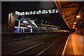
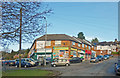
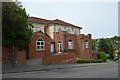
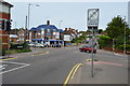
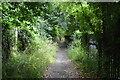
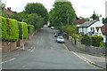
49 photos from this area
Area Information
Key information about the HP13 6DR including its size, population, and administrative classification.
- Area Type
- Postcode
- Area Size
- 3921 m²
- Population
- 1358
- Population Density
- 6427 people/km²
House Prices in HP13 6DR
14
Properties
£274,700
Average Sold Price
£188,000
Lowest Price
£350,000
Highest Price
Showing 14 properties
| Address | Type | Beds | Baths | Last Sale Price | Last Sale Date | |
|---|---|---|---|---|---|---|
| 19 Totteridge Road, High Wycombe, HP13 6DR | house | 2 | - | £330,000 | Aug 2025 | |
| 7 Totteridge Road, High Wycombe, HP13 6DR | Semi-detached | 2 | 1 | £325,000 | Feb 2021 | |
| 13 Totteridge Road, High Wycombe, HP13 6DR | Terraced | 2 | 1 | £350,000 | Jul 2018 | |
| 17 Totteridge Road, High Wycombe, HP13 6DR | Terraced | 2 | 1 | £311,000 | Nov 2016 | |
| 23 Totteridge Road, High Wycombe, HP13 6DR | house | 3 | - | £325,000 | Dec 2014 | |
| 15 Totteridge Road, High Wycombe, HP13 6DR | house | - | - | £238,000 | Dec 2013 | |
| 9 Totteridge Road, High Wycombe, HP13 6DR | house | - | - | £250,000 | Sep 2013 | |
| 11 Totteridge Road, High Wycombe, HP13 6DR | house | 2 | - | £235,000 | Oct 2010 | |
| 5 Totteridge Road, High Wycombe, HP13 6DR | Semi-detached | 2 | 1 | £188,000 | Jun 2007 | |
| 21 Totteridge Road, High Wycombe, HP13 6DR | Semi-detached | 4 | 1 | £195,000 | Jan 2007 |
Page 1 of 2
Energy Efficiency in HP13 6DR
Amenities
Schools
| Rank | School | Type | Entry gender | Ages |
|---|
Explore more schools in this area
Go to Schools tabDemographics
Household Size
One person
most common
Accommodation Type
Flats
most common
Tenure
47
majority
Ethnic Group
White
most common
Religion
N/A
most common
Household Composition
N/A
most common
Age
47
median
Adults (30-64 years)
most common
Household Deprivation
N/A
with no deprivation
NS-SEC
42
in Lower managerial occupations
Explore more demographic insights in this area
Go to Demographics tabPlanning
Planning Constraints
- Flood RiskPremium
- Ramsar Wetland SitesPremium
- Area of Outstanding Natural BeautyPremium
- Protected Nature ReservePremium
- Protected WoodlandPremium