Area Overview for HP13 5SA
Photos of HP13 5SA
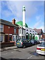
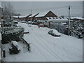
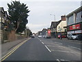
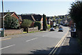
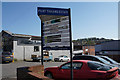
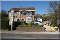
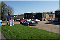
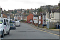
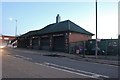
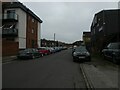
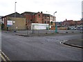
30 photos from this area
Area Information
Key information about the HP13 5SA including its size, population, and administrative classification.
- Area Type
- Postcode
- Area Size
- 3.5 hectares
- Population
- 1486
- Population Density
- 7056 people/km²
House Prices in HP13 5SA
40
Properties
£147,505
Average Sold Price
£100,000
Lowest Price
£185,000
Highest Price
Showing 40 properties
| Address | Type | Beds | Baths | Last Sale Price | Last Sale Date | |
|---|---|---|---|---|---|---|
| 15 Malvern Close, High Wycombe, HP13 5SA | Flat | 1 | 1 | £178,000 | Mar 2025 | |
| 14 Malvern Close, High Wycombe, HP13 5SA | Maisonette | 1 | 1 | £170,000 | Dec 2022 | |
| 5 Malvern Close, High Wycombe, HP13 5SA | Flat | 1 | 1 | £185,000 | Oct 2022 | |
| 10 Malvern Close, High Wycombe, HP13 5SA | Flat | - | - | £132,000 | Sep 2021 | |
| 29 Malvern Close, High Wycombe, HP13 5SA | Flat | 1 | - | £157,000 | Nov 2019 | |
| 7 Malvern Close, High Wycombe, HP13 5SA | Flat | - | - | £165,000 | Aug 2019 | |
| 37 Malvern Close, High Wycombe, HP13 5SA | Flat | - | - | £133,000 | Jun 2015 | |
| 20 Malvern Close, High Wycombe, HP13 5SA | Maisonette | 1 | 1 | £125,000 | Jan 2014 | |
| 23 Malvern Close, High Wycombe, HP13 5SA | Flat | 1 | 1 | £100,000 | Oct 2013 | |
| 30 Malvern Close, High Wycombe, HP13 5SA | Flat | - | - | £130,050 | Aug 2007 |
Page 1 of 4
Energy Efficiency in HP13 5SA
Amenities
Schools
| Rank | School | Type | Entry gender | Ages |
|---|
Explore more schools in this area
Go to Schools tabDemographics
Household Size
One person
most common
Accommodation Type
Houses
most common
Tenure
40
majority
Ethnic Group
White
most common
Religion
N/A
most common
Household Composition
N/A
most common
Age
47
median
Adults (30-64 years)
most common
Household Deprivation
N/A
with no deprivation
NS-SEC
22
in Lower managerial occupations
Explore more demographic insights in this area
Go to Demographics tabPlanning
Planning Constraints
- Flood RiskPremium
- Ramsar Wetland SitesPremium
- Area of Outstanding Natural BeautyPremium
- Protected Nature ReservePremium
- Protected WoodlandPremium