Area Overview for HP13 5BH
Photos of HP13 5BH
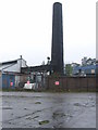

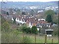
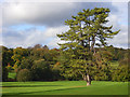
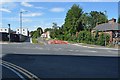
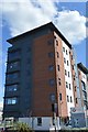
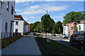
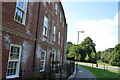
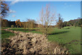
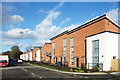
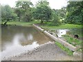
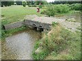
32 photos from this area
Area Information
Key information about the HP13 5BH including its size, population, and administrative classification.
- Area Type
- Postcode
- Area Size
- 1.6 hectares
- Population
- 1609
- Population Density
- 2560 people/km²
House Prices in HP13 5BH
25
Properties
£533,333
Average Sold Price
£250,000
Lowest Price
£895,000
Highest Price
Showing 25 properties
| Address | Type | Beds | Baths | Last Sale Price | Last Sale Date | |
|---|---|---|---|---|---|---|
| 31 Hamilton Road, High Wycombe, HP13 5BH | Detached | 4 | 5 | £895,000 | Jun 2025 | |
| 45 Hamilton Road, High Wycombe, HP13 5BH | Detached | 5 | 2 | £710,000 | Oct 2024 | |
| 25 Hamilton Road, High Wycombe, HP13 5BH | house | 3 | 1 | £582,500 | Jan 2022 | |
| 51 Hamilton Road, High Wycombe, HP13 5BH | Retail | 4 | 2 | £850,000 | Jan 2022 | |
| 73 Hamilton Road, High Wycombe, HP13 5BH | Detached | 3 | 1 | £600,000 | Apr 2021 | |
| 39 Hamilton Road, High Wycombe, HP13 5BH | Detached | 3 | 1 | £585,000 | Jan 2021 | |
| 71 Hamilton Road, High Wycombe, HP13 5BH | Detached | 4 | 2 | £630,000 | Oct 2019 | |
| 33 Hamilton Road, High Wycombe, HP13 5BH | Detached | 3 | 2 | £540,000 | Dec 2016 | |
| 75 Hamilton Road, High Wycombe, HP13 5BH | Detached | - | - | £695,000 | Sep 2016 | |
| 37 Hamilton Road, High Wycombe, HP13 5BH | Semi-detached | 4 | 2 | £450,000 | Jan 2016 |
Page 1 of 3
Energy Efficiency in HP13 5BH
Amenities
Schools
| Rank | School | Type | Entry gender | Ages |
|---|
Explore more schools in this area
Go to Schools tabDemographics
Household Size
Two person
most common
Accommodation Type
Houses
most common
Tenure
79
majority
Ethnic Group
White
most common
Religion
N/A
most common
Household Composition
N/A
most common
Age
47
median
Adults (30-64 years)
most common
Household Deprivation
N/A
with no deprivation
NS-SEC
57
in Lower managerial occupations
Explore more demographic insights in this area
Go to Demographics tabPlanning
Planning Constraints
- Flood RiskPremium
- Ramsar Wetland SitesPremium
- Area of Outstanding Natural BeautyPremium
- Protected Nature ReservePremium
- Protected WoodlandPremium