Area Overview for HP12 4TL
Photos of HP12 4TL
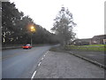
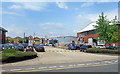

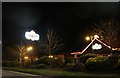
20 photos from this area
Area Information
Key information about the HP12 4TL including its size, population, and administrative classification.
- Area Type
- Postcode
- Area Size
- 7694 m²
- Population
- 1767
- Population Density
- 4592 people/km²
House Prices in HP12 4TL
25
Properties
£238,275
Average Sold Price
£86,950
Lowest Price
£375,000
Highest Price
Showing 25 properties
| Address | Type | Beds | Baths | Last Sale Price | Last Sale Date | |
|---|---|---|---|---|---|---|
| 36 Sycamore Road, High Wycombe, HP12 4TL | Terraced | 3 | 1 | £335,000 | Jun 2024 | |
| 30 Sycamore Road, High Wycombe, HP12 4TL | Terraced | 3 | 1 | £375,000 | Mar 2023 | |
| 22 Sycamore Road, High Wycombe, HP12 4TL | Retail | 3 | 1 | £365,000 | Oct 2022 | |
| 42 Sycamore Road, High Wycombe, HP12 4TL | house | - | - | £350,000 | Feb 2022 | |
| 16 Sycamore Road, High Wycombe, HP12 4TL | Terraced | 3 | 1 | £310,000 | Jul 2016 | |
| 28 Sycamore Road, High Wycombe, HP12 4TL | house | - | - | £239,950 | Sep 2014 | |
| 10 Sycamore Road, High Wycombe, HP12 4TL | Terraced | 3 | - | £202,000 | Feb 2013 | |
| 14 Sycamore Road, High Wycombe, HP12 4TL | Terraced | - | - | £218,000 | Jul 2012 | |
| 32 Sycamore Road, High Wycombe, HP12 4TL | Terraced | - | - | £225,000 | Jul 2007 | |
| 26 Sycamore Road, High Wycombe, HP12 4TL | Terraced | - | - | £184,000 | Feb 2006 |
Page 1 of 3
Energy Efficiency in HP12 4TL
Amenities
Schools
| Rank | School | Type | Entry gender | Ages |
|---|
Explore more schools in this area
Go to Schools tabDemographics
Household Size
One person
most common
Accommodation Type
Houses
most common
Tenure
57
majority
Ethnic Group
White
most common
Religion
N/A
most common
Household Composition
N/A
most common
Age
47
median
Adults (30-64 years)
most common
Household Deprivation
N/A
with no deprivation
NS-SEC
29
in Lower managerial occupations
Explore more demographic insights in this area
Go to Demographics tabPlanning
Planning Constraints
- Flood RiskPremium
- Ramsar Wetland SitesPremium
- Area of Outstanding Natural BeautyPremium
- Protected Nature ReservePremium
- Protected WoodlandPremium