Area Overview for HP12 4QU
Photos of HP12 4QU
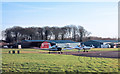
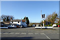
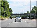
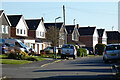
27 photos from this area
Area Information
Key information about the HP12 4QU including its size, population, and administrative classification.
- Area Type
- Postcode
- Area Size
- 2.4 hectares
- Population
- 1576
- Population Density
- 1018 people/km²
House Prices in HP12 4QU
28
Properties
£405,547
Average Sold Price
£142,550
Lowest Price
£565,000
Highest Price
Showing 28 properties
| Address | Type | Beds | Baths | Last Sale Price | Last Sale Date | |
|---|---|---|---|---|---|---|
| 19 Willow Avenue, High Wycombe, HP12 4QU | house | - | - | £560,000 | Jun 2021 | |
| 20 Willow Avenue, High Wycombe, HP12 4QU | house | 4 | - | £517,500 | May 2021 | |
| 23 Willow Avenue, High Wycombe, HP12 4QU | Detached | 4 | 2 | £540,000 | Oct 2019 | |
| 4 Willow Avenue, High Wycombe, HP12 4QU | Detached | 3 | 2 | £445,000 | Aug 2018 | |
| 7 Willow Avenue, High Wycombe, HP12 4QU | house | - | - | £565,000 | Nov 2017 | |
| 16 Willow Avenue, High Wycombe, HP12 4QU | house | - | - | £497,500 | Sep 2017 | |
| 14 Willow Avenue, High Wycombe, HP12 4QU | Detached | 4 | - | £450,000 | Aug 2015 | |
| 26 Willow Avenue, High Wycombe, HP12 4QU | Detached | 4 | 2 | £460,000 | Sep 2014 | |
| 21 Willow Avenue, High Wycombe, HP12 4QU | Detached | 4 | 2 | £347,700 | May 2014 | |
| 28 Willow Avenue, High Wycombe, HP12 4QU | house | - | - | £450,000 | Jan 2013 |
Page 1 of 3
Energy Efficiency in HP12 4QU
Amenities
Schools
| Rank | School | Type | Entry gender | Ages |
|---|
Explore more schools in this area
Go to Schools tabDemographics
Household Size
Two person
most common
Accommodation Type
Houses
most common
Tenure
85
majority
Ethnic Group
White
most common
Religion
N/A
most common
Household Composition
N/A
most common
Age
47
median
Adults (30-64 years)
most common
Household Deprivation
N/A
with no deprivation
NS-SEC
38
in Lower managerial occupations
Explore more demographic insights in this area
Go to Demographics tabPlanning
Planning Constraints
- Flood RiskPremium
- Ramsar Wetland SitesPremium
- Area of Outstanding Natural BeautyPremium
- Protected Nature ReservePremium
- Protected WoodlandPremium