Area Overview for HP12 4NF
Photos of HP12 4NF
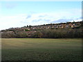
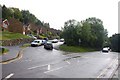

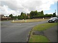
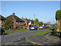

18 photos from this area
Area Information
Key information about the HP12 4NF including its size, population, and administrative classification.
- Area Type
- Postcode
- Area Size
- 2.2 hectares
- Population
- 1706
- Population Density
- 4271 people/km²
House Prices in HP12 4NF
39
Properties
£300,221
Average Sold Price
£78,000
Lowest Price
£540,000
Highest Price
Showing 39 properties
| Address | Type | Beds | Baths | Last Sale Price | Last Sale Date | |
|---|---|---|---|---|---|---|
| 53 Arundel Road, High Wycombe, HP12 4NF | Semi-detached | 3 | 1 | £440,000 | Aug 2025 | |
| 55 Arundel Road, High Wycombe, HP12 4NF | Semi-detached | 3 | 1 | £443,500 | Mar 2025 | |
| 52 Arundel Road, High Wycombe, HP12 4NF | Detached | 4 | 2 | £540,000 | Jan 2025 | |
| 59 Arundel Road, High Wycombe, HP12 4NF | Semi-detached | 3 | 1 | £452,500 | Jul 2024 | |
| 63A Arundel Road, High Wycombe, HP12 4NF | Semi-detached | 3 | 1 | £375,000 | Oct 2023 | |
| 59A Arundel Road, High Wycombe, HP12 4NF | Semi-detached | 3 | 1 | £495,000 | Oct 2023 | |
| 60A Arundel Road, High Wycombe, HP12 4NF | Semi-detached | 3 | - | £372,000 | Dec 2021 | |
| 60 Arundel Road, High Wycombe, HP12 4NF | house | - | - | £336,000 | Sep 2021 | |
| 65 Arundel Road, High Wycombe, HP12 4NF | house | - | - | £335,000 | Aug 2021 | |
| 54 Arundel Road, High Wycombe, HP12 4NF | house | 3 | - | £375,000 | Jun 2021 |
Page 1 of 4
Energy Efficiency in HP12 4NF
Amenities
Schools
| Rank | School | Type | Entry gender | Ages |
|---|
Explore more schools in this area
Go to Schools tabDemographics
Household Size
Family (3-5 people)
most common
Accommodation Type
Houses
most common
Tenure
59
majority
Ethnic Group
White
most common
Religion
N/A
most common
Household Composition
N/A
most common
Age
47
median
Adults (30-64 years)
most common
Household Deprivation
N/A
with no deprivation
NS-SEC
30
in Lower managerial occupations
Explore more demographic insights in this area
Go to Demographics tabPlanning
Planning Constraints
- Flood RiskPremium
- Ramsar Wetland SitesPremium
- Area of Outstanding Natural BeautyPremium
- Protected Nature ReservePremium
- Protected WoodlandPremium