Area Overview for HP12 4DS
Photos of HP12 4DS
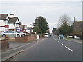
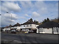
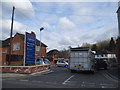
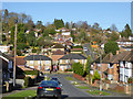
29 photos from this area
Area Information
Key information about the HP12 4DS including its size, population, and administrative classification.
- Area Type
- Postcode
- Area Size
- 8002 m²
- Population
- 1507
- Population Density
- 3289 people/km²
House Prices in HP12 4DS
8
Properties
£369,421
Average Sold Price
£91,000
Lowest Price
£489,950
Highest Price
Showing 8 properties
| Address | Type | Beds | Baths | Last Sale Price | Last Sale Date | |
|---|---|---|---|---|---|---|
| Millstone, Applewick Lane, High Wycombe, HP12 4DS | Detached | 3 | 2 | £489,950 | Jun 2019 | |
| Orchard Mews, Applewick Lane, High Wycombe, HP12 4DS | Detached | 4 | 2 | £485,000 | Dec 2017 | |
| Pepin, Applewick Lane, High Wycombe, HP12 4DS | Detached | 4 | 2 | £380,000 | Aug 2009 | |
| Oaken Pin, Applewick Lane, High Wycombe, HP12 4DS | Detached | - | - | £415,000 | Sep 2007 | |
| Lavinia, Applewick Lane, High Wycombe, HP12 4DS | Detached | - | - | £365,000 | May 2004 | |
| Braeburn, Applewick Lane, High Wycombe, HP12 4DS | Detached | - | - | £360,000 | Apr 2004 | |
| Shanklin, Applewick Lane, High Wycombe, HP12 4DS | Detached | - | - | £91,000 | Feb 1996 | |
| The Warren, Applewick Lane, High Wycombe, HP12 4DS | Detached | - | - | - | - |
Energy Efficiency in HP12 4DS
Amenities
Schools
| Rank | School | Type | Entry gender | Ages |
|---|
Explore more schools in this area
Go to Schools tabDemographics
Household Size
Family (3-5 people)
most common
Accommodation Type
Houses
most common
Tenure
75
majority
Ethnic Group
White
most common
Religion
N/A
most common
Household Composition
N/A
most common
Age
47
median
Adults (30-64 years)
most common
Household Deprivation
N/A
with no deprivation
NS-SEC
38
in Lower managerial occupations
Explore more demographic insights in this area
Go to Demographics tabPlanning
Planning Constraints
- Flood RiskPremium
- Ramsar Wetland SitesPremium
- Area of Outstanding Natural BeautyPremium
- Protected Nature ReservePremium
- Protected WoodlandPremium