Area Overview for HP12 4DP
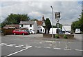
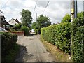
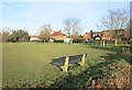
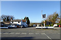
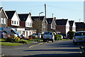
Photos of HP12 4DP


Area Information
Living in HP12 4DP offers a quiet, residential experience in a small cluster of homes, catering to a mature population. With a population of 1,767, the area feels intimate, with a focus on established households. The median age of 47 suggests a community of adults in their prime working years, many of whom are homeowners. This postcode is characterised by its low-key charm, with homes predominantly set in a suburban layout. Daily life here is shaped by proximity to essential services, including nearby rail stations and a local hospital school. While not a bustling urban hub, HP12 4DP provides a stable environment for families and individuals seeking a balance between accessibility and tranquillity. The area’s small size means it is easy to navigate, with a sense of familiarity among residents. Its location near High Wycombe and surrounding towns ensures that commuters can reach major employment centres swiftly. For those prioritising safety and a settled lifestyle, HP12 4DP presents a compelling option.
- Area Type
- Postcode
- Area Size
- Not available
- Population
- 1767
- Population Density
- 4592 people/km²
HP12 4DP is a small area with a housing stock dominated by owner-occupied homes. With 57% of properties owned by residents, the market is less rental-focused than many urban areas, though 43% are available for rent. The prevalence of houses over flats or apartments suggests a community that values private, spacious living. Given the area’s limited size, the property market is likely to be tight, with few new developments. Buyers should expect homes that are well-established, often with gardens or outdoor space, reflecting the suburban character of the area. The relatively low population density means competition for properties may be limited, but this also means fewer choices for buyers. Those seeking a home in HP12 4DP are likely to find properties that cater to families or individuals prioritising privacy and a settled environment.
House Prices in HP12 4DP
No properties found in this postcode.
Energy Efficiency in HP12 4DP
Residents of HP12 4DP have access to a range of amenities within practical reach. The area includes five retail outlets, such as Asda High, Tesco High, and Aldi Crest Road, providing essential shopping options. Nearby rail stations, including High Wycombe and Marlow, offer convenient links to larger towns and cities, while Wycombe Air Park provides a gateway to regional travel. Although the data does not mention parks or leisure facilities, the presence of multiple rail stations and retail options suggests a lifestyle that balances local convenience with easy access to broader services. The area’s proximity to High Wycombe also means residents can enjoy the town’s amenities, from dining to cultural attractions, without long commutes.
Amenities
Schools
The nearest school to HP12 4DP is High Wycombe Hospital School, a special school catering to students with specific educational needs. While no other schools are listed in the data, this suggests that families requiring specialist provision may find the area suitable. However, those seeking mainstream primary or secondary education will need to look beyond HP12 4DP. The presence of a special school highlights the area’s role in supporting diverse educational requirements, though it does not offer a comprehensive range of school types. For families with children needing standard schooling, proximity to other educational institutions in nearby towns like High Wycombe or Marlow would be essential.
| Rank | School | Type | Entry gender | Ages |
|---|
Explore more schools in this area
Go to Schools tabDemographics
The community in HP12 4DP is predominantly composed of adults aged 30–64, with a median age of 47. This suggests a population that is largely in their middle years, with many likely to be in established careers or nearing retirement. Home ownership is strong here, with 57% of properties owned by residents, compared to 43% rented. The accommodation type is primarily houses, reflecting a preference for single-family homes over flats or apartments. The predominant ethnic group is White, though no specific data on diversity or deprivation is provided. This demographic profile indicates a stable, long-term resident base, with fewer transient populations. The low median age and high home ownership suggest a community focused on family living and long-term investment. For buyers, this means a market where properties are likely to be well-maintained and suited to those seeking a settled lifestyle.
Household Size
Accommodation Type
Tenure
Ethnic Group
Religion
Household Composition
Age
Household Deprivation
NS-SEC
Explore more demographic insights in this area
Go to Demographics tabPlanning
Planning Constraints
- Flood RiskPremium
- Ramsar Wetland SitesPremium
- Area of Outstanding Natural BeautyPremium
- Protected Nature ReservePremium
- Protected WoodlandPremium