Area Overview for HP12 3TN
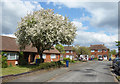
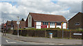
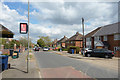
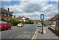
Photos of HP12 3TN


Area Information
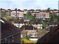
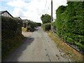
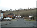
Living in HP12 3TN offers a quiet, residential experience in a small cluster of homes, with a population of 1,728 residents. This area is defined by its compact size and the presence of family-oriented housing. The community is predominantly composed of adults aged 30–64, reflecting a mature demographic with a median age of 47. Home ownership is high at 70%, suggesting a stable, long-term resident base. The area’s character is shaped by its proximity to local amenities, including retail stores like Tesco High and Asda, as well as rail connections to High Wycombe and Marlow stations. While it lacks large urban hubs, HP12 3TN provides access to essential services within practical reach. The presence of Oakridge School, rated good by Ofsted, adds to its appeal for families. Its small size means a close-knit community feel, though residents may need to travel slightly for specialist services. The area’s low flood risk and absence of environmental constraints make it a practical choice for those seeking safety and simplicity.
- Area Type
- Postcode
- Area Size
- Not available
- Population
- 1728
- Population Density
- 3185 people/km²
The property market in HP12 3TN is dominated by owner-occupied homes, with 70% of properties owned by residents rather than rented. The accommodation type is primarily houses, which is typical for small, rural or semi-rural postcode areas. This suggests a market skewed towards established homeowners rather than young professionals or renters. The limited size of the area means the housing stock is unlikely to include high-density developments or new builds. Buyers should expect a mix of older, family-sized homes, which may appeal to those seeking space and stability. The absence of significant rental activity indicates that property values are likely to be held by long-term residents. For those considering the area, the focus on single-family homes means the market is more suited to buyers prioritising living space over investment potential.
House Prices in HP12 3TN
No properties found in this postcode.
Energy Efficiency in HP12 3TN
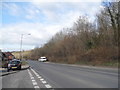
The lifestyle in HP12 3TN is shaped by its proximity to essential amenities. Residents have access to five retail outlets, including Tesco High, Aldi Crest Road, and Asda High, providing everyday shopping needs. The area’s rail network, with stations at High Wycombe, Marlow, and Saunderton, offers easy access to larger towns and cities. While there are no major parks or leisure facilities listed in the data, the absence of environmental constraints like protected woodlands or AONB areas suggests open spaces may be available nearby. The presence of Wycombe Air Park adds a unique element for aviation enthusiasts. For daily life, the mix of retail and transport options supports a practical, low-maintenance lifestyle. However, those seeking extensive recreational facilities may need to look beyond the immediate area. The balance of convenience and simplicity makes HP12 3TN appealing to those valuing accessibility over large-scale amenities.
Amenities
Schools
The nearest school to HP12 3TN is Oakridge School, a primary institution with a good Ofsted rating. This provides a reliable option for families with younger children, though the area lacks secondary schools within immediate reach. The presence of a primary school with a good rating suggests a focus on early education quality, which is a key consideration for parents. However, residents requiring secondary schooling may need to travel to nearby towns such as High Wycombe or Marlow, which host larger educational institutions. The single school in the area means limited competition for places but also fewer educational options for older students. For families prioritising proximity to schools, Oakridge’s performance offers reassurance, though additional research into nearby secondary schools would be necessary for long-term planning.
| Rank | School | Type | Entry gender | Ages |
|---|
Explore more schools in this area
Go to Schools tabDemographics
The population of HP12 3TN is 1,728, with a median age of 47. The majority of residents fall within the 30–64 age range, indicating a community of middle-aged and older adults. Home ownership is strong at 70%, reflecting a focus on long-term residency rather than rental properties. The accommodation type is predominantly houses, which aligns with the area’s residential character. The predominant ethnic group is Asian, though specific subgroups are not detailed. This demographic profile suggests a stable, established community with limited generational turnover. The absence of data on deprivation or income levels means no direct conclusions can be drawn about economic challenges, but the high home ownership rate and mature age profile imply a relatively secure financial environment. Families with children may find the area’s single primary school, Oakridge, a key factor in their decision to settle here.
Household Size
Accommodation Type
Tenure
Ethnic Group
Religion
Household Composition
Age
Household Deprivation
NS-SEC
Explore more demographic insights in this area
Go to Demographics tabPlanning
Planning Constraints
- Flood RiskPremium
- Ramsar Wetland SitesPremium
- Area of Outstanding Natural BeautyPremium
- Protected Nature ReservePremium
- Protected WoodlandPremium