Area Overview for HP12 3NX
Photos of HP12 3NX
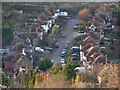
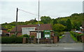
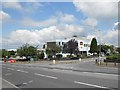
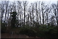
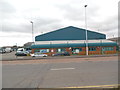
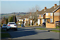
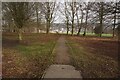
20 photos from this area
Area Information
Key information about the HP12 3NX including its size, population, and administrative classification.
- Area Type
- Postcode
- Area Size
- 9468 m²
- Population
- 1651
- Population Density
- 3817 people/km²
House Prices in HP12 3NX
15
Properties
£326,722
Average Sold Price
£227,500
Lowest Price
£470,000
Highest Price
Showing 15 properties
| Address | Type | Beds | Baths | Last Sale Price | Last Sale Date | |
|---|---|---|---|---|---|---|
| 5 Knights Hill, High Wycombe, HP12 3NX | Detached | 3 | 1 | £470,000 | Feb 2024 | |
| 18 Knights Hill, High Wycombe, HP12 3NX | Detached | 3 | 1 | £355,000 | Oct 2019 | |
| 12 Knights Hill, High Wycombe, HP12 3NX | Detached | 3 | 1 | £375,000 | Mar 2018 | |
| 6 Knights Hill, High Wycombe, HP12 3NX | Detached | 3 | 1 | £378,000 | Jan 2018 | |
| 2 Knights Hill, High Wycombe, HP12 3NX | Detached | 3 | 1 | £385,000 | Sep 2016 | |
| 14 Knights Hill, High Wycombe, HP12 3NX | house | 3 | - | £245,000 | Mar 2012 | |
| 9 Knights Hill, High Wycombe, HP12 3NX | Detached | - | - | £227,500 | Mar 2009 | |
| 10 Knights Hill, High Wycombe, HP12 3NX | Detached | - | - | £270,000 | Apr 2006 | |
| 16 Knights Hill, High Wycombe, HP12 3NX | house | - | - | £235,000 | Aug 2004 | |
| 3 Knights Hill, High Wycombe, HP12 3NX | Detached | 3 | 1 | - | - |
Page 1 of 2
Energy Efficiency in HP12 3NX
Amenities
Schools
| Rank | School | Type | Entry gender | Ages |
|---|
Explore more schools in this area
Go to Schools tabDemographics
Household Size
Family (3-5 people)
most common
Accommodation Type
Houses
most common
Tenure
71
majority
Ethnic Group
asian_total
most common
Religion
N/A
most common
Household Composition
N/A
most common
Age
47
median
Adults (30-64 years)
most common
Household Deprivation
N/A
with no deprivation
NS-SEC
31
in Lower managerial occupations
Explore more demographic insights in this area
Go to Demographics tabPlanning
Planning Constraints
- Flood RiskPremium
- Ramsar Wetland SitesPremium
- Area of Outstanding Natural BeautyPremium
- Protected Nature ReservePremium
- Protected WoodlandPremium