Area Overview for HP12 3HN
Photos of HP12 3HN
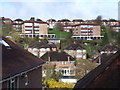
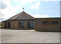
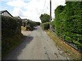
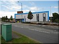
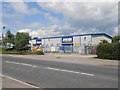
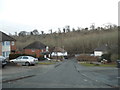
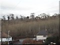
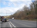
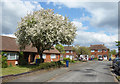
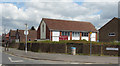
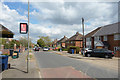
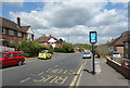
21 photos from this area
Area Information
Key information about the HP12 3HN including its size, population, and administrative classification.
- Area Type
- Postcode
- Area Size
- 2.3 hectares
- Population
- 1749
- Population Density
- 9842 people/km²
House Prices in HP12 3HN
55
Properties
£192,878
Average Sold Price
£55,000
Lowest Price
£395,000
Highest Price
Showing 55 properties
| Address | Type | Beds | Baths | Last Sale Price | Last Sale Date | |
|---|---|---|---|---|---|---|
| 122 Chairborough Road, High Wycombe, HP12 3HN | Semi-detached | 4 | 1 | £344,200 | Sep 2020 | |
| 130 Chairborough Road, High Wycombe, HP12 3HN | Semi-detached | 3 | 1 | £320,000 | Jan 2020 | |
| 92 Chairborough Road, High Wycombe, HP12 3HN | house | 3 | 1 | £310,000 | Mar 2019 | |
| 113 Chairborough Road, High Wycombe, HP12 3HN | Semi-detached | 3 | 1 | £395,000 | Feb 2019 | |
| 111 Chairborough Road, High Wycombe, HP12 3HN | Semi-detached | 4 | 1 | £375,000 | Oct 2017 | |
| 135 Chairborough Road, High Wycombe, HP12 3HN | house | 3 | - | £325,000 | May 2017 | |
| 112 Chairborough Road, High Wycombe, HP12 3HN | Semi-detached | 3 | 1 | £230,000 | Jan 2017 | |
| 120 Chairborough Road, High Wycombe, HP12 3HN | Semi-detached | 3 | - | £267,000 | Mar 2016 | |
| 137A Chairborough Road, High Wycombe, HP12 3HN | Bungalow | 4 | 2 | £250,000 | Nov 2013 | |
| 99 Chairborough Road, High Wycombe, HP12 3HN | house | 4 | - | £205,000 | Sep 2008 |
Page 1 of 6
Energy Efficiency in HP12 3HN
Amenities
Schools
| Rank | School | Type | Entry gender | Ages |
|---|
Explore more schools in this area
Go to Schools tabDemographics
Household Size
Family (3-5 people)
most common
Accommodation Type
Houses
most common
Tenure
55
majority
Ethnic Group
asian_total
most common
Religion
N/A
most common
Household Composition
N/A
most common
Age
47
median
Adults (30-64 years)
most common
Household Deprivation
N/A
with no deprivation
NS-SEC
18
in Lower managerial occupations
Explore more demographic insights in this area
Go to Demographics tabPlanning
Planning Constraints
- Flood RiskPremium
- Ramsar Wetland SitesPremium
- Area of Outstanding Natural BeautyPremium
- Protected Nature ReservePremium
- Protected WoodlandPremium