Area Overview for HP12 3EA
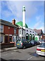
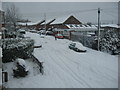
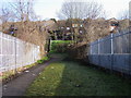
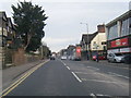
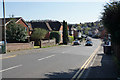
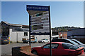
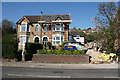
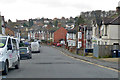
Photos of HP12 3EA

Area Information
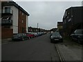
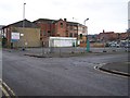
HP12 3EA is a compact residential postcode in England, covering just 4,777 square metres and home to 1,972 residents. Its high population density—412,852 people per square kilometre—reflects a tightly knit community. This area is defined by its proximity to key transport links, including High Wycombe, Saunderton, and Marlow railway stations, which connect residents to London and surrounding towns. The postcode’s small size means it is likely a single neighbourhood with a distinct local character. Daily life here is shaped by its mix of residential housing and practical amenities, including nearby retail outlets and a nearby airport. While the area lacks major natural or protected sites, its accessibility and compact layout make it appealing for those prioritising convenience over rural tranquillity. The presence of 5 retail outlets, including Budgens High and Aldi Baker, ensures basic shopping needs are met within easy reach. For buyers, HP12 3EA offers a snapshot of suburban living with a focus on connectivity and proximity to services.
- Area Type
- Postcode
- Area Size
- 4777 m²
- Population
- 1972
- Population Density
- 11307 people/km²
The property market in HP12 3EA is characterised by a 48% home ownership rate, meaning nearly half of properties are owner-occupied, while the remaining 52% are likely rented. The accommodation type is predominantly houses, which may imply a focus on larger, more traditional properties. This suggests the area is not heavily influenced by apartment blocks or high-density housing, appealing to those seeking private, family-friendly homes. Given the postcode’s small size, the housing stock is likely limited, making it a niche market for buyers seeking specific properties. The presence of railway stations nearby may enhance its appeal for commuters, though the compact nature of HP12 3EA means buyers should consider the immediate surroundings for more options. The mix of ownership and rental properties indicates a stable market, but with limited scope for expansion.
House Prices in HP12 3EA
No properties found in this postcode.
Energy Efficiency in HP12 3EA
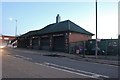
Living in HP12 3EA offers access to a range of practical amenities within close proximity. The area includes five retail outlets, such as Budgens High, Lidl Central High, and Aldi Baker, ensuring everyday shopping needs are met without long journeys. Nearby railway stations—High Wycombe, Saunderton, and Marlow—provide easy access to regional transport networks, while Wycombe Air Park adds a unique element to the area’s connectivity. Though there are no major parks or leisure facilities listed, the compact layout suggests a focus on convenience over expansive recreational spaces. The presence of multiple railway stations also implies a commuter-oriented lifestyle, with residents likely relying on public transport for work or social activities. For those prioritising accessibility and essential services, HP12 3EA delivers a functional, if modest, lifestyle with a strong emphasis on practicality.
Amenities
Schools
| Rank | School | Type | Entry gender | Ages |
|---|
Explore more schools in this area
Go to Schools tabDemographics
The population of HP12 3EA has a median age of 47, with the majority of residents aged between 30 and 64. This suggests a community of established adults, likely focused on stability and long-term living. Home ownership rates stand at 48%, indicating a balanced mix of owner-occupied and rental properties. The predominant accommodation type is houses, which may reflect a preference for family homes or larger living spaces. The area’s dominant ethnic group is Asian, which shapes its cultural dynamics and community identity. While no specific deprivation data is provided, the high population density and presence of essential retail services suggest that residents have access to basic amenities. The age profile and home ownership figures indicate a mature, settled population, with fewer young families or transient residents compared to other areas.
Household Size
Accommodation Type
Tenure
Ethnic Group
Religion
Household Composition
Age
Household Deprivation
NS-SEC
Explore more demographic insights in this area
Go to Demographics tabPlanning
Planning Constraints
- Flood RiskPremium
- Ramsar Wetland SitesPremium
- Area of Outstanding Natural BeautyPremium
- Protected Nature ReservePremium
- Protected WoodlandPremium