Area Overview for HP12 3BJ
Photos of HP12 3BJ
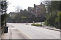
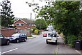
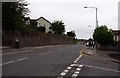
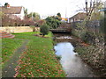
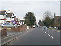
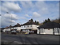
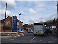
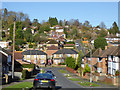
29 photos from this area
Area Information
Key information about the HP12 3BJ including its size, population, and administrative classification.
- Area Type
- Postcode
- Area Size
- 4155 m²
- Population
- 2137
- Population Density
- 6313 people/km²
House Prices in HP12 3BJ
23
Properties
£159,000
Average Sold Price
£46,000
Lowest Price
£327,000
Highest Price
Showing 23 properties
| Address | Type | Beds | Baths | Last Sale Price | Last Sale Date | |
|---|---|---|---|---|---|---|
| 140 Abercromby Avenue, High Wycombe, HP12 3BJ | house | - | - | £175,000 | Sep 2023 | |
| 132 Abercromby Avenue, High Wycombe, HP12 3BJ | Semi-detached | 3 | - | £327,000 | Aug 2023 | |
| 136 Abercromby Avenue, High Wycombe, HP12 3BJ | Semi-detached | 2 | 1 | £265,000 | Oct 2019 | |
| 144 Abercromby Avenue, High Wycombe, HP12 3BJ | Semi-detached | 3 | 1 | £235,000 | Jan 2015 | |
| 112A Abercromby Avenue, High Wycombe, HP12 3BJ | house | - | - | £135,000 | Jun 2014 | |
| 122 Abercromby Avenue, High Wycombe, HP12 3BJ | Flat | - | - | £89,500 | Jan 2013 | |
| 120 Abercromby Avenue, High Wycombe, HP12 3BJ | Semi-detached | - | - | £180,000 | Mar 2007 | |
| 124 Abercromby Avenue, High Wycombe, HP12 3BJ | Flat | - | - | £87,500 | May 2003 | |
| 116 Abercromby Avenue, High Wycombe, HP12 3BJ | Terraced | - | - | £46,000 | Aug 1996 | |
| 142 Abercromby Avenue, High Wycombe, HP12 3BJ | house | - | - | £50,000 | Mar 1995 |
Page 1 of 3
Energy Efficiency in HP12 3BJ
Amenities
Schools
| Rank | School | Type | Entry gender | Ages |
|---|
Explore more schools in this area
Go to Schools tabDemographics
Household Size
One person
most common
Accommodation Type
Flats
most common
Tenure
44
majority
Ethnic Group
White
most common
Religion
N/A
most common
Household Composition
N/A
most common
Age
47
median
Adults (30-64 years)
most common
Household Deprivation
N/A
with no deprivation
NS-SEC
30
in Lower managerial occupations
Explore more demographic insights in this area
Go to Demographics tabPlanning
Planning Constraints
- Flood RiskPremium
- Ramsar Wetland SitesPremium
- Area of Outstanding Natural BeautyPremium
- Protected Nature ReservePremium
- Protected WoodlandPremium