Area Overview for HP11 2XA
Photos of HP11 2XA
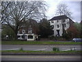
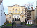
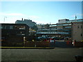
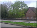
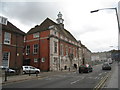
98 photos from this area
Area Information
Key information about the HP11 2XA including its size, population, and administrative classification.
- Area Type
- Postcode
- Area Size
- 2.0 hectares
- Population
- 2359
- Population Density
- 2349 people/km²
House Prices in HP11 2XA
12
Properties
£450,913
Average Sold Price
£235,000
Lowest Price
£600,000
Highest Price
Showing 12 properties
| Address | Type | Beds | Baths | Last Sale Price | Last Sale Date | |
|---|---|---|---|---|---|---|
| 11 Tennyson Road, High Wycombe, HP11 2XA | Retail | 3 | 1 | £595,000 | Oct 2022 | |
| 8 Tennyson Road, High Wycombe, HP11 2XA | Detached | 4 | - | £600,000 | Mar 2021 | |
| 10 Tennyson Road, High Wycombe, HP11 2XA | Detached | 4 | 3 | £575,000 | Oct 2020 | |
| 12 TENNYSON ROAD, High Wycombe, HP11 2XA | Detached | - | - | £570,000 | Apr 2020 | |
| 7 Tennyson Road, High Wycombe, HP11 2XA | Detached | 4 | 2 | £550,000 | Aug 2016 | |
| 2 Tennyson Road, High Wycombe, HP11 2XA | house | 4 | - | £399,950 | Sep 2014 | |
| 3 Tennyson Road, High Wycombe, HP11 2XA | Bungalow | - | - | £350,000 | Jun 2013 | |
| 6 Tennyson Road, High Wycombe, HP11 2XA | Detached | 4 | 2 | £430,000 | Jul 2011 | |
| 1 Tennyson Road, High Wycombe, HP11 2XA | Detached | - | - | £365,000 | Jan 2007 | |
| 5 Tennyson Road, High Wycombe, HP11 2XA | Detached | 4 | 1 | £455,000 | Jan 2007 |
Page 1 of 2
Energy Efficiency in HP11 2XA
Amenities
Schools
| Rank | School | Type | Entry gender | Ages |
|---|
Explore more schools in this area
Go to Schools tabDemographics
Household Size
One person
most common
Accommodation Type
Flats
most common
Tenure
37
majority
Ethnic Group
White
most common
Religion
N/A
most common
Household Composition
N/A
most common
Age
22
median
Adults (30-64 years)
most common
Household Deprivation
N/A
with no deprivation
NS-SEC
34
in Lower managerial occupations
Explore more demographic insights in this area
Go to Demographics tabPlanning
Planning Constraints
- Flood RiskPremium
- Ramsar Wetland SitesPremium
- Area of Outstanding Natural BeautyPremium
- Protected Nature ReservePremium
- Protected WoodlandPremium