Area Overview for HP11 2UN
Photos of HP11 2UN
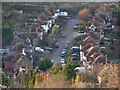
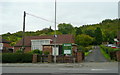
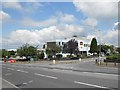
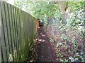
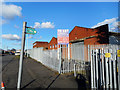
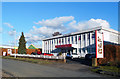
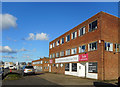
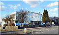
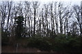
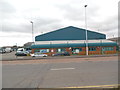
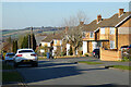
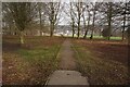
20 photos from this area
Area Information
Key information about the HP11 2UN including its size, population, and administrative classification.
- Area Type
- Postcode
- Area Size
- 1.2 hectares
- Population
- 2359
- Population Density
- 2349 people/km²
House Prices in HP11 2UN
15
Properties
£320,438
Average Sold Price
£140,000
Lowest Price
£565,000
Highest Price
Showing 15 properties
| Address | Type | Beds | Baths | Last Sale Price | Last Sale Date | |
|---|---|---|---|---|---|---|
| 6 Kingsley Crescent, High Wycombe, HP11 2UN | house | - | - | £565,000 | Oct 2021 | |
| 14 Kingsley Crescent, High Wycombe, HP11 2UN | Bungalow | 4 | - | £450,000 | Aug 2014 | |
| 12 Kingsley Crescent, High Wycombe, HP11 2UN | Detached | 4 | - | £420,000 | Jun 2014 | |
| 5 Kingsley Crescent, High Wycombe, HP11 2UN | house | - | - | £280,000 | May 2014 | |
| 7 Kingsley Crescent, High Wycombe, HP11 2UN | Detached | - | - | £350,000 | Jun 2009 | |
| 1 Kingsley Crescent, High Wycombe, HP11 2UN | Detached | - | - | £200,000 | Mar 2005 | |
| 3 Kingsley Crescent, High Wycombe, HP11 2UN | house | - | - | £158,500 | Sep 1998 | |
| Loakes View, Kingsley Crescent, High Wycombe, HP11 2UN | Detached | - | - | £140,000 | Mar 1995 | |
| 11 Kingsley Crescent, High Wycombe, HP11 2UN | Detached | 4 | 3 | - | - | |
| 10 Kingsley Crescent, High Wycombe, HP11 2UN | Detached | 4 | 1 | - | - |
Page 1 of 2
Energy Efficiency in HP11 2UN
Amenities
Schools
| Rank | School | Type | Entry gender | Ages |
|---|
Explore more schools in this area
Go to Schools tabDemographics
Household Size
One person
most common
Accommodation Type
Flats
most common
Tenure
37
majority
Ethnic Group
White
most common
Religion
N/A
most common
Household Composition
N/A
most common
Age
22
median
Adults (30-64 years)
most common
Household Deprivation
N/A
with no deprivation
NS-SEC
34
in Lower managerial occupations
Explore more demographic insights in this area
Go to Demographics tabPlanning
Planning Constraints
- Flood RiskPremium
- Ramsar Wetland SitesPremium
- Area of Outstanding Natural BeautyPremium
- Protected Nature ReservePremium
- Protected WoodlandPremium