Area Overview for HP11 2UA
Photos of HP11 2UA
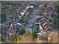
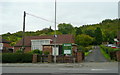
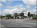
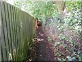
20 photos from this area
Area Information
Key information about the HP11 2UA including its size, population, and administrative classification.
- Area Type
- Postcode
- Area Size
- 5.2 hectares
- Population
- 2359
- Population Density
- 2349 people/km²
House Prices in HP11 2UA
38
Properties
£325,623
Average Sold Price
£91,950
Lowest Price
£690,000
Highest Price
Showing 38 properties
| Address | Type | Beds | Baths | Last Sale Price | Last Sale Date | |
|---|---|---|---|---|---|---|
| 16 Carver Hill Road, High Wycombe, HP11 2UA | house | - | - | £512,000 | Mar 2025 | |
| 36 Carver Hill Road, High Wycombe, HP11 2UA | Semi-detached | 3 | - | £520,000 | Jan 2025 | |
| 76 Carver Hill Road, High Wycombe, HP11 2UA | Semi-detached | 5 | 3 | £690,000 | Jan 2025 | |
| 44 Carver Hill Road, High Wycombe, HP11 2UA | Semi-detached | 3 | 1 | £575,000 | Aug 2024 | |
| 32 Carver Hill Road, High Wycombe, HP11 2UA | house | - | - | £460,000 | Jun 2021 | |
| 40 Carver Hill Road, High Wycombe, HP11 2UA | house | - | - | £210,000 | Jan 2021 | |
| 52 Carver Hill Road, High Wycombe, HP11 2UA | house | 1 | 3 | £500,000 | Jan 2021 | |
| 14 Carver Hill Road, High Wycombe, HP11 2UA | Semi-detached | 1 | 3 | £478,000 | Nov 2020 | |
| 46 Carver Hill Road, High Wycombe, HP11 2UA | Semi-detached | 3 | 1 | £407,500 | May 2016 | |
| 64 Carver Hill Road, High Wycombe, HP11 2UA | Bungalow | 3 | 2 | £387,500 | Nov 2015 |
Page 1 of 4
Energy Efficiency in HP11 2UA
Amenities
Schools
| Rank | School | Type | Entry gender | Ages |
|---|
Explore more schools in this area
Go to Schools tabDemographics
Household Size
One person
most common
Accommodation Type
Flats
most common
Tenure
37
majority
Ethnic Group
White
most common
Religion
N/A
most common
Household Composition
N/A
most common
Age
22
median
Adults (30-64 years)
most common
Household Deprivation
N/A
with no deprivation
NS-SEC
34
in Lower managerial occupations
Explore more demographic insights in this area
Go to Demographics tabPlanning
Planning Constraints
- Flood RiskPremium
- Ramsar Wetland SitesPremium
- Area of Outstanding Natural BeautyPremium
- Protected Nature ReservePremium
- Protected WoodlandPremium