Area Overview for HP11 2ST
Photos of HP11 2ST
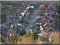
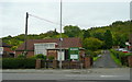
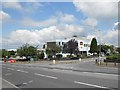
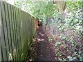
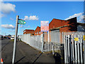
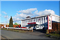
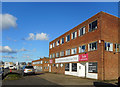
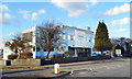
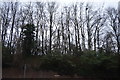
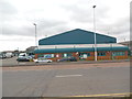
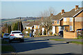
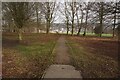
20 photos from this area
Area Information
Key information about the HP11 2ST including its size, population, and administrative classification.
- Area Type
- Postcode
- Area Size
- 2.6 hectares
- Population
- 1651
- Population Density
- 3817 people/km²
House Prices in HP11 2ST
31
Properties
£290,117
Average Sold Price
£85,000
Lowest Price
£625,000
Highest Price
Showing 31 properties
| Address | Type | Beds | Baths | Last Sale Price | Last Sale Date | |
|---|---|---|---|---|---|---|
| 159 Desborough Avenue, High Wycombe, HP11 2ST | Semi-detached | 4 | 4 | £475,000 | Aug 2024 | |
| 185 Desborough Avenue, High Wycombe, HP11 2ST | Semi-detached | 4 | 1 | £625,000 | Mar 2022 | |
| 171 Desborough Avenue, High Wycombe, HP11 2ST | Semi-detached | 3 | 1 | £232,000 | May 2021 | |
| 181 Desborough Avenue, High Wycombe, HP11 2ST | house | - | - | £535,000 | Feb 2021 | |
| 169 Desborough Avenue, High Wycombe, HP11 2ST | house | - | - | £383,000 | Sep 2020 | |
| 147 Desborough Avenue, High Wycombe, HP11 2ST | Semi-detached | 3 | 1 | £260,000 | Sep 2019 | |
| 165 Desborough Avenue, High Wycombe, HP11 2ST | Semi-detached | 3 | 2 | £370,000 | Jun 2019 | |
| 191A Desborough Avenue, High Wycombe, HP11 2ST | Flat | - | - | £575,000 | Oct 2018 | |
| 139 Desborough Avenue, High Wycombe, HP11 2ST | Bungalow | 3 | - | £310,000 | Jul 2016 | |
| Calver Ridge, Desborough Avenue, High Wycombe, HP11 2ST | house | - | - | £370,000 | Dec 2014 |
Page 1 of 4
Energy Efficiency in HP11 2ST
Amenities
Schools
| Rank | School | Type | Entry gender | Ages |
|---|
Explore more schools in this area
Go to Schools tabDemographics
Household Size
Family (3-5 people)
most common
Accommodation Type
Houses
most common
Tenure
71
majority
Ethnic Group
asian_total
most common
Religion
N/A
most common
Household Composition
N/A
most common
Age
47
median
Adults (30-64 years)
most common
Household Deprivation
N/A
with no deprivation
NS-SEC
31
in Lower managerial occupations
Explore more demographic insights in this area
Go to Demographics tabPlanning
Planning Constraints
- Flood RiskPremium
- Ramsar Wetland SitesPremium
- Area of Outstanding Natural BeautyPremium
- Protected Nature ReservePremium
- Protected WoodlandPremium