Area Overview for HP11 2NQ
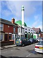
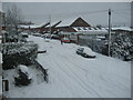
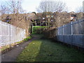
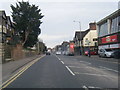
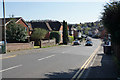
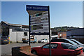
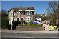
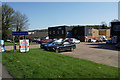
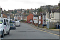
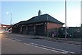
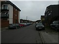
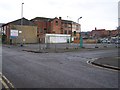
Photos of HP11 2NQ
Area Information
Living in HP11 2NQ offers a quiet, compact residential experience in a small cluster of homes. With a population of 2,300, the area is characterised by a mature community, where the median age of 47 suggests a stable, long-established demographic. This postcode is ideal for those seeking a low-key lifestyle, with limited housing stock that reflects its small scale. The area is well-served by nearby rail links, including High Wycombe and Marlow stations, which connect residents to larger towns and cities. Daily life here is shaped by proximity to essential amenities, such as local shops and a mix of retail options, while the surrounding countryside provides a sense of tranquillity. HP11 2NQ is not a high-density area, so residents can expect a slower pace of life, with a focus on community and local services. The mix of flats and the 40% home ownership rate indicates a blend of rental and owner-occupied properties, though the small size of the area means housing choices are limited. For buyers, this postcode represents a niche market, offering simplicity and proximity to transport without the bustle of urban centres.
- Area Type
- Postcode
- Area Size
- Not available
- Population
- 2300
- Population Density
- 7156 people/km²
The property market in HP11 2NQ is defined by a 40% home ownership rate, meaning the majority of residents rent their homes. This suggests a rental market that may be more prominent than owner-occupation, possibly due to the area’s small size and limited housing stock. The predominant accommodation type is flats, which is typical for smaller, residential clusters. This configuration may appeal to buyers seeking low-maintenance properties or those prioritising proximity to transport links, such as nearby rail stations. However, the limited number of homes in the area means the market is niche, with little scope for expansion or new developments. For buyers, this postcode offers a rare opportunity to own a home in a compact, quiet setting, though the small size may restrict availability. The focus on flats also means that properties are likely to be smaller, which could be a consideration for those needing more space. Overall, the market is best suited to those seeking a simple, low-key living environment with easy access to rail networks.
House Prices in HP11 2NQ
No properties found in this postcode.
Energy Efficiency in HP11 2NQ
The lifestyle in HP11 2NQ is shaped by its proximity to essential amenities, including five retail outlets such as Lidl Central High, Budgens High, and Aldi Baker. These shops provide convenience for daily errands, though the small size of the area means the selection is limited. The rail stations in the vicinity, including High Wycombe and Marlow, offer access to broader shopping, dining, and leisure opportunities in nearby towns. The presence of Wycombe Air Park adds a unique element to the area’s connectivity, though its role in daily life is not specified. For residents, the compact nature of HP11 2NQ means that amenities are within practical reach, but the lack of larger parks or recreational facilities may require trips to nearby areas for leisure. The area’s character is defined by its quiet, residential feel, with a focus on local services and transport links. While the amenities are sufficient for basic needs, those seeking a wider range of leisure options may need to look beyond the immediate postcode.
Amenities
Schools
Residents of HP11 2NQ have access to a range of educational institutions, including Green Street First School, a primary school, and Unity College, a special needs school with an Ofsted rating of 'good'. The presence of a primary school ensures that younger children can attend local education without long commutes, while Unity College caters to students with specific learning needs. The Middle School Centre, though not rated by Ofsted, adds to the variety of educational options. This mix of school types means families can find support for both mainstream and specialist education within the area. However, the absence of secondary schools in the immediate vicinity may require parents to consider commuting to nearby towns for higher education. The availability of a special needs school is a notable advantage, offering tailored support for children with additional requirements. Overall, the school landscape in HP11 2NQ provides a foundation for early education and specialist care but may lack the full range of options needed for older students.
| Rank | School | Type | Entry gender | Ages |
|---|
Explore more schools in this area
Go to Schools tabDemographics
The community in HP11 2NQ is predominantly composed of adults aged 30–64, with a median age of 47. This suggests a mature, settled population, likely with long-term ties to the area. Home ownership rates here are 40%, meaning 60% of residents rent their homes, indicating a rental market that may cater to professionals or those requiring flexibility. The accommodation type is primarily flats, which aligns with the area’s compact nature. The predominant ethnic group is White, though no specific data on diversity or deprivation is provided. The age profile implies a community with established careers and families, though the absence of data on household composition means it is unclear whether the area hosts single-person households, couples, or larger families. The 40% home ownership rate suggests that many residents may be renters, possibly including commuters or those in temporary housing. The lack of specific data on deprivation or income levels means it is difficult to assess the area’s economic challenges, but the stable age range and housing stock suggest a relatively consistent quality of life for residents.
Household Size
Accommodation Type
Tenure
Ethnic Group
Religion
Household Composition
Age
Household Deprivation
NS-SEC
Explore more demographic insights in this area
Go to Demographics tabPlanning
Planning Constraints
- Flood RiskPremium
- Ramsar Wetland SitesPremium
- Area of Outstanding Natural BeautyPremium
- Protected Nature ReservePremium
- Protected WoodlandPremium