Area Overview for HP11 2LJ
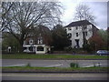
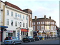
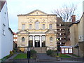
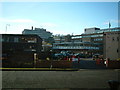
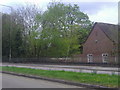
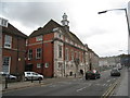
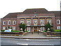
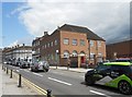
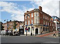
Photos of HP11 2LJ

Area Information
Living in HP11 2LJ means being part of a tightly packed residential cluster in England, where 2,557 people reside across 6,295 square metres. The area’s population density of 406,197 people per square kilometre reflects its compact nature, typical of small postcode areas. This is a place where daily life is shaped by proximity to local amenities and transport links. Residents benefit from nearby schools, retail hubs, and rail stations, making it practical for commuters and families. The area’s small size means a close-knit community feel, though the high population density may influence the pace of life. With a median age of 47, the area is home to a predominantly adult population, many in their prime working years. While the data does not specify local landmarks, the presence of nearby schools and transport infrastructure suggests a functional, service-oriented environment. For buyers, HP11 2LJ offers a blend of practicality and accessibility, though its limited space means every home is part of a densely populated network.
- Area Type
- Postcode
- Area Size
- 6295 m²
- Population
- 2557
- Population Density
- 4222 people/km²
The property market in HP11 2LJ is characterised by a low home ownership rate of 33%, suggesting that the area is more rental-focused than owner-occupied. The predominant accommodation type is flats, which aligns with the postcode’s small size and high population density. This means the housing stock is likely to be smaller units, suitable for individuals or couples rather than larger families. The compact nature of the area may limit the availability of larger homes, making it a niche market for buyers seeking affordable, space-efficient properties. For those considering investment, the rental market could be viable, though competition for properties may be high due to the area’s limited size. Buyers should also consider the surrounding areas, as the immediate vicinity may offer more diverse housing options. The focus on flats suggests a practical, no-frills approach to living, ideal for those prioritising convenience over expansive living spaces.
House Prices in HP11 2LJ
Showing 3 properties
| Address | Type | Beds | Baths | Last Sale Price | Last Sale Date | |
|---|---|---|---|---|---|---|
| Flat 1, 11 Rutland Street, High Wycombe, HP11 2LJ | Flat | - | - | - | - | |
| Flat 2, 11 Rutland Street, High Wycombe, HP11 2LJ | Flat | - | - | - | - | |
| Shelburne Lodge Care Home, Shelburne Lodge, 11 Rutland Street, High Wycombe, HP11 2LJ | hospital_care_home | - | - | - | - |
Energy Efficiency in HP11 2LJ
The lifestyle in HP11 2LJ is shaped by its proximity to retail, transport, and leisure facilities. The area’s retail scene includes notable venues such as Tesco High, M&S Eden, and Sainsburys High, providing everyday shopping needs within easy reach. Rail stations like High Wycombe and Marlow offer access to broader networks, while Wycombe Air Park serves as a local aviation hub. Though the area is small, its amenities are conveniently clustered, reducing the need for long commutes. The presence of a ‘good’-rated primary school adds to the appeal for families, though secondary education options are limited to nearby institutions. The compact design of the area fosters a sense of immediacy, where daily errands and social interactions are within walking or short driving distance. For buyers, the lifestyle reflects a balance between practicality and accessibility, though the area’s size may require residents to venture further for specialist services.
Amenities
Schools
Residents of HP11 2LJ have access to a primary school, High Wycombe Church of England Combined School, which holds a ‘good’ Ofsted rating. This provides a solid foundation for local children’s education, though the area lacks secondary schools. The nearby Buckinghamshire New University, categorised as an ‘other’ institution, serves higher education needs but is not a school for younger students. The mix of a primary school and a higher education provider suggests a community that supports both early and advanced learning. Families with children may need to look beyond the immediate area for secondary schooling, but the presence of a well-rated primary school is a positive for those prioritising local education. The absence of additional schools highlights the importance of considering proximity to other educational institutions when evaluating the area’s suitability for families.
| Rank | School | Type | Entry gender | Ages |
|---|
Explore more schools in this area
Go to Schools tabDemographics
The community in HP11 2LJ is predominantly composed of adults aged 30–64, with a median age of 47. This suggests a mature, settled population, likely with established careers and family structures. Home ownership is relatively low at 33%, indicating that a significant portion of residents live in rental properties. The area’s accommodation is largely flats, which may reflect its compact design and the need for space-efficient housing. The predominant ethnic group is White, though no further breakdown of diversity is provided. With a population density over 400,000 per square kilometre, the area is highly populated, which may influence local services and social dynamics. The data does not specify deprivation levels, but the combination of low home ownership and high density could suggest a mix of socioeconomic profiles. For families, the presence of a primary school with a ‘good’ Ofsted rating offers a local education option, though higher education is served by Buckinghamshire New University, a non-primary institution.
Household Size
Accommodation Type
Tenure
Ethnic Group
Religion
Household Composition
Age
Household Deprivation
NS-SEC
Explore more demographic insights in this area
Go to Demographics tabPlanning
Planning Constraints
- Flood RiskPremium
- Ramsar Wetland SitesPremium
- Area of Outstanding Natural BeautyPremium
- Protected Nature ReservePremium
- Protected WoodlandPremium