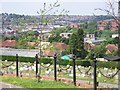
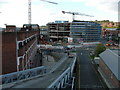
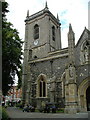
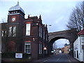
Area Overview for HP11 2BS
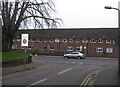
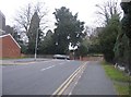
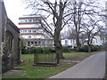
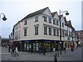
Photos of HP11 2BS
Area Information
HP11 2BS is a compact residential postcode in England, home to 2,359 people spread across a densely populated area with 2,349 residents per square kilometre. This small cluster of homes sits at the intersection of convenience and community, with proximity to key amenities and transport links. The area’s character is defined by its mix of young and middle-aged residents, many of whom live in flats, reflecting a rental-oriented market. Despite its size, HP11 2BS offers access to independent schools like Wycombe Abbey, rail stations including High Wycombe and Marlow, and a nearby airfield. Daily life here is shaped by the high population density, which means residents are close to shops, services, and transport. The area’s appeal lies in its practicality—residents can reach major routes and amenities within minutes. However, the compact nature of HP11 2BS also means the housing stock is limited, with a strong emphasis on flats rather than detached homes. For those seeking a small, connected community with access to urban infrastructure, this postcode provides a blend of proximity and practicality.
- Area Type
- Postcode
- Area Size
- Not available
- Population
- 2359
- Population Density
- 2349 people/km²
The property market in HP11 2BS is characterised by a low home ownership rate of 37%, suggesting that the area is primarily a rental market. The accommodation type is almost exclusively flats, which are more common in densely populated areas. This configuration means that owner-occupied homes are rare, and the housing stock is limited to smaller, shared living spaces. For buyers, this presents challenges: the small size of the postcode and the prevalence of flats mean there are fewer opportunities for purchasing detached or semi-detached properties. The area’s compact nature also means that the immediate surroundings may offer more options, but buyers should expect a competitive market for any available owner-occupied properties. The focus on rental housing may appeal to those seeking short-term or flexible living arrangements but may not suit those prioritising long-term ownership.
House Prices in HP11 2BS
No properties found in this postcode.
Energy Efficiency in HP11 2BS
Residents of HP11 2BS have access to a range of amenities within practical reach. The area includes five retail venues, such as Iceland High, Sainsburys High, and M&S Eden, providing everyday shopping options. Rail stations like High Wycombe, Bourne End, and Marlow offer connections to broader transport networks, while Wycombe Air Park adds a unique local feature. Though the data does not detail parks or leisure facilities, the proximity to retail and transport hubs suggests a lifestyle focused on convenience and connectivity. The presence of multiple shops and rail links means daily errands and travel are efficient, though the area’s small size may limit options for larger leisure or recreational spaces. The character of HP11 2BS is defined by its accessibility and practicality, catering to those who prioritise ease of movement over expansive amenities.
Amenities
Schools
The nearest school to HP11 2BS is Wycombe Abbey, an independent school. This institution is likely a draw for families seeking private education, though no Ofsted rating or academic performance data is provided in the available information. The presence of an independent school suggests that the area may attract households prioritising private schooling, though it is unclear how many residents utilise this facility. The absence of state schools in the data means that families relying on public education may need to look further afield. The single listed school highlights the importance of proximity to educational institutions for families considering HP11 2BS, though the lack of additional schools may limit options for those requiring multiple schooling choices.
| Rank | School | Type | Entry gender | Ages |
|---|
Explore more schools in this area
Go to Schools tabDemographics
The population of HP11 2BS has a median age of 22, but the most common age group is adults aged 30–64, suggesting a mix of younger residents and a more established demographic. Home ownership here is relatively low at 37%, indicating that the majority of residents rent their homes. The accommodation type is predominantly flats, which aligns with the area’s high population density. The predominant ethnic group is White, though no further breakdown of diversity is provided. The age profile implies a community that may include students, young professionals, and families, though the absence of specific data on deprivation or income levels means the quality of life for residents remains less defined. The high proportion of renters and flats suggests a transient or economically diverse population, with limited data on long-term stability or community cohesion.
Household Size
Accommodation Type
Tenure
Ethnic Group
Religion
Household Composition
Age
Household Deprivation
NS-SEC
Explore more demographic insights in this area
Go to Demographics tabPlanning
Planning Constraints
- Flood RiskPremium
- Ramsar Wetland SitesPremium
- Area of Outstanding Natural BeautyPremium
- Protected Nature ReservePremium
- Protected WoodlandPremium