Area Overview for HP11 1UE
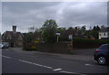
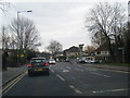
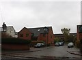
Photos of HP11 1UE


Area Information
Living in HP11 1UE means being part of a tightly knit residential cluster in England, where the population of 1,607 residents occupies a compact area with a high density of 1,365 people per square kilometre. This postcode is characterised by a mix of practicality and accessibility, with proximity to rail networks and essential amenities. The area’s appeal lies in its balance of small-community charm and connectivity, making it suitable for those seeking a quieter lifestyle without sacrificing convenience. Daily life here is shaped by the presence of nearby shops, transport links, and low environmental risks. With a median age of 47 and a population skewed towards adults aged 30–64, HP11 1UE is a stable, mature community where most residents own their homes. The area’s compact nature means it is ideal for those prioritising ease of access to services, while its low crime risk and minimal planning constraints offer reassurance for long-term residents.
- Area Type
- Postcode
- Area Size
- Not available
- Population
- 1607
- Population Density
- 1365 people/km²
The property market in HP11 1UE is dominated by owner-occupied homes, with 77% of residents living in houses rather than flats or other formats. This indicates a market that prioritises private ownership over rental properties, which may reflect the area’s appeal to families and long-term residents. The prevalence of houses suggests a focus on space and privacy, though the small size of the postcode means housing stock is limited. Buyers should consider that the area’s compact nature may restrict availability, but it also fosters a close-knit community. For those seeking a home in HP11 1UE, the emphasis on owner-occupation and traditional housing types means properties are likely to be in stable demand, particularly among those valuing security and established neighbourhoods.
House Prices in HP11 1UE
No properties found in this postcode.
Energy Efficiency in HP11 1UE
Residents of HP11 1UE have access to a range of local amenities, including five retail outlets such as Aldi Tannery, Morrisons Daily, and M&S Wycombe Marsh SF. These shops provide everyday essentials, reducing the need for long trips. The proximity to rail stations like High Wycombe and Beaconsfield ensures easy access to broader services, dining, and leisure opportunities in nearby towns. While the area itself is small, its integration with surrounding networks means residents can enjoy a mix of local convenience and regional diversity. The presence of multiple rail options also supports a lifestyle that prioritises ease of movement, whether for work, shopping, or socialising.
Amenities
Schools
| Rank | School | Type | Entry gender | Ages |
|---|
Explore more schools in this area
Go to Schools tabDemographics
The community in HP11 1UE is predominantly composed of adults aged 30–64, with a median age of 47. This suggests a population that is largely established in careers and family life, contributing to a stable local economy. Home ownership is high, with 77% of residents living in owner-occupied properties, indicating a preference for long-term residency. The accommodation type is primarily houses, which aligns with the area’s residential character. The predominant ethnic group is White, reflecting the demographic profile of the surrounding region. While the data does not specify diversity metrics, the absence of notable deprivation indicators implies a relatively consistent quality of life. The age profile and ownership figures suggest a community focused on stability, with limited turnover of residents.
Household Size
Accommodation Type
Tenure
Ethnic Group
Religion
Household Composition
Age
Household Deprivation
NS-SEC
Explore more demographic insights in this area
Go to Demographics tabPlanning
Planning Constraints
- Flood RiskPremium
- Ramsar Wetland SitesPremium
- Area of Outstanding Natural BeautyPremium
- Protected Nature ReservePremium
- Protected WoodlandPremium