Area Overview for HP11 1TL
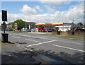
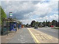
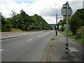
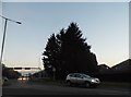
Photos of HP11 1TL


Area Information
Living in HP11 1TL means inhabiting a tightly packed residential cluster in England, where 1,641 people reside across just 2.0 hectares. This density creates a compact, community-focused environment, though it also means space is at a premium. The area’s population is dominated by adults aged 30–64, reflecting a mature, established demographic. Daily life here is shaped by proximity to essential services, with nearby schools, rail links, and retail hubs within practical reach. While the area lacks sprawling green spaces or large public amenities, its small footprint ensures convenience for those prioritising accessibility over open space. The presence of multiple railway stations and a nearby airport suggests this is a commuter hub, with residents likely relying on public transport to access larger towns. HP11 1TL’s character is defined by its mix of residential tranquillity and the logistical demands of a high-density postcode, making it a choice for those valuing connectivity over isolation.
- Area Type
- Postcode
- Area Size
- 2.0 hectares
- Population
- 1641
- Population Density
- 2377 people/km²
The property market in HP11 1TL is defined by a 63% home ownership rate, with houses making up the predominant accommodation type. This suggests a market skewed towards owner-occupied properties rather than rentals, though the small area size and high density may limit housing stock. The presence of houses in a compact postcode implies a mix of semi-detached or terraced homes, which are common in such settings. For buyers, this means competition for available properties, as the area’s limited space restricts new developments. The high population density also means that properties are likely to be in close proximity to neighbours, which could be a consideration for those seeking privacy. The market’s stability, driven by long-term residents, may offer predictable value retention, though buyers should assess whether the area’s constraints align with their long-term needs.
House Prices in HP11 1TL
No properties found in this postcode.
Energy Efficiency in HP11 1TL
Residents of HP11 1TL have access to a range of amenities within practical reach, including five retail outlets such as Aldi Crest Road, Tesco High Wycombe, and Waitrose High. These shops provide everyday convenience, from groceries to household goods. The area’s rail network, with stations like High Wycombe and Marlow, offers easy access to nearby towns, while Wycombe Air Park provides an alternative for those needing regional or international travel. Though the data does not mention parks or leisure facilities, the proximity to multiple railway stations and retail hubs suggests a lifestyle focused on connectivity and convenience. The compact nature of the area means amenities are closely grouped, reducing travel time for daily tasks. However, the absence of detailed information on green spaces or recreational facilities means buyers should consider whether these are priorities for their lifestyle.
Amenities
Schools
Residents of HP11 1TL have access to several schools, including Chepping View Primary School, Shelburne Infant School, and Cressex Community School, which holds an Ofsted rating of ‘good’. These primary schools serve younger families, while special schools such as Vinio House School and Park Crescent School cater to specific educational needs. The mix of school types reflects a diverse educational landscape, accommodating both mainstream and specialist provision. For families, this means a range of options for their children’s schooling, though the absence of secondary schools in the immediate area may require commuting. The presence of multiple primary schools suggests a focus on early education, which is crucial for young families considering the area. However, the lack of data on secondary education or school performance beyond Ofsted ratings means buyers should investigate further for comprehensive insights.
| Rank | School | Type | Entry gender | Ages |
|---|
Explore more schools in this area
Go to Schools tabDemographics
HP11 1TL’s population of 1,641 is overwhelmingly composed of adults aged 30–64, with a median age of 47. This suggests a community of middle-aged residents, many of whom may be in their peak earning years or nearing retirement. Home ownership rates here stand at 63%, indicating a stable, long-term resident base rather than a transient rental market. The accommodation type is predominantly houses, which is unusual for a high-density postcode, hinting at a mix of larger properties and perhaps some detached homes. The predominant ethnic group is White, though no specific data on diversity or deprivation is provided. The population density of 83,579 people per square kilometre is exceptionally high, which may influence the area’s character, fostering a tightly knit but potentially overcrowded environment. This density could impact local amenities, requiring efficient planning to meet demand.
Household Size
Accommodation Type
Tenure
Ethnic Group
Religion
Household Composition
Age
Household Deprivation
NS-SEC
Explore more demographic insights in this area
Go to Demographics tabPlanning
Planning Constraints
- Flood RiskPremium
- Ramsar Wetland SitesPremium
- Area of Outstanding Natural BeautyPremium
- Protected Nature ReservePremium
- Protected WoodlandPremium