Area Overview for HP11 1JQ
Photos of HP11 1JQ
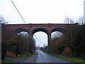
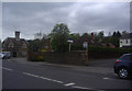
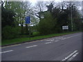
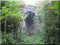
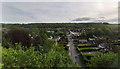
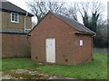
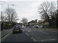
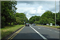
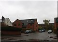
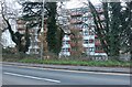
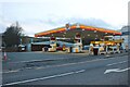
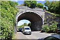
30 photos from this area
Area Information
Key information about the HP11 1JQ including its size, population, and administrative classification.
- Area Type
- Postcode
- Area Size
- 3.2 hectares
- Population
- 1379
- Population Density
- 2373 people/km²
House Prices in HP11 1JQ
11
Properties
£318,333
Average Sold Price
£95,500
Lowest Price
£475,000
Highest Price
Showing 11 properties
| Address | Type | Beds | Baths | Last Sale Price | Last Sale Date | |
|---|---|---|---|---|---|---|
| 194A Kingsmead Road, High Wycombe, HP11 1JQ | Terraced | 3 | 3 | £475,000 | Feb 2024 | |
| 184 Kingsmead Road, High Wycombe, HP11 1JQ | house | 3 | - | £475,000 | Dec 2021 | |
| 194 Kingsmead Road, High Wycombe, HP11 1JQ | house | - | - | £360,000 | Mar 2021 | |
| 186 Kingsmead Road, High Wycombe, HP11 1JQ | Terraced | 3 | 2 | £347,500 | Feb 2020 | |
| 188 Kingsmead Road, High Wycombe, HP11 1JQ | house | 3 | 2 | £419,000 | Aug 2017 | |
| 190 Kingsmead Road, High Wycombe, HP11 1JQ | Semi-detached | 3 | 2 | £393,000 | Oct 2016 | |
| 193 Kingsmead Road, High Wycombe, HP11 1JQ | Semi-detached | - | - | £145,000 | Jun 2004 | |
| 195 Kingsmead Road, High Wycombe, HP11 1JQ | Semi-detached | 2 | - | £155,000 | Aug 2001 | |
| 192 Kingsmead Road, High Wycombe, HP11 1JQ | house | - | - | £95,500 | Mar 1995 | |
| 196 Kingsmead Road, High Wycombe, HP11 1JQ | Detached | - | - | - | - |
Page 1 of 2
Energy Efficiency in HP11 1JQ
Amenities
Schools
| Rank | School | Type | Entry gender | Ages |
|---|
Explore more schools in this area
Go to Schools tabDemographics
Household Size
One person
most common
Accommodation Type
Houses
most common
Tenure
49
majority
Ethnic Group
White
most common
Religion
N/A
most common
Household Composition
N/A
most common
Age
47
median
Adults (30-64 years)
most common
Household Deprivation
N/A
with no deprivation
NS-SEC
34
in Lower managerial occupations
Explore more demographic insights in this area
Go to Demographics tabPlanning
Planning Constraints
- Flood RiskPremium
- Ramsar Wetland SitesPremium
- Area of Outstanding Natural BeautyPremium
- Protected Nature ReservePremium
- Protected WoodlandPremium