Area Overview for HP11 1FD
Photos of HP11 1FD
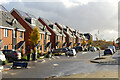


18 photos from this area
Area Information
Key information about the HP11 1FD including its size, population, and administrative classification.
- Area Type
- Postcode
- Area Size
- 3.0 hectares
- Population
- 2618
- Population Density
- 2361 people/km²
House Prices in HP11 1FD
32
Properties
£662,931
Average Sold Price
£525,000
Lowest Price
£760,000
Highest Price
Showing 32 properties
| Address | Type | Beds | Baths | Last Sale Price | Last Sale Date | |
|---|---|---|---|---|---|---|
| 38 Trinity Circle, High Wycombe, HP11 1FD | Detached | 4 | 3 | £600,000 | Oct 2025 | |
| 50 Trinity Circle, High Wycombe, HP11 1FD | Semi-detached | 4 | 2 | £620,000 | Dec 2024 | |
| 56 Trinity Circle, High Wycombe, HP11 1FD | house | - | - | £600,000 | Aug 2024 | |
| 54 Trinity Circle, High Wycombe, HP11 1FD | Semi-detached | 4 | 2 | £590,000 | Nov 2023 | |
| 36 Trinity Circle, High Wycombe, HP11 1FD | Detached | - | - | £676,389 | Jun 2021 | |
| 34 Trinity Circle, High Wycombe, HP11 1FD | Detached | - | - | £721,500 | Mar 2021 | |
| 40 Trinity Circle, High Wycombe, HP11 1FD | Semi-detached | 4 | 2 | £545,000 | Dec 2020 | |
| 32 Trinity Circle, High Wycombe, HP11 1FD | house | - | - | £735,000 | Oct 2020 | |
| 30 Trinity Circle, High Wycombe, HP11 1FD | house | - | - | £715,000 | Oct 2020 | |
| 42 Trinity Circle, High Wycombe, HP11 1FD | house | - | - | £650,000 | Oct 2020 |
Page 1 of 4
Energy Efficiency in HP11 1FD
Amenities
Schools
| Rank | School | Type | Entry gender | Ages |
|---|
Explore more schools in this area
Go to Schools tabDemographics
Household Size
Family (3-5 people)
most common
Accommodation Type
Houses
most common
Tenure
72
majority
Ethnic Group
White
most common
Religion
N/A
most common
Household Composition
N/A
most common
Age
47
median
Adults (30-64 years)
most common
Household Deprivation
N/A
with no deprivation
NS-SEC
52
in Lower managerial occupations
Explore more demographic insights in this area
Go to Demographics tabPlanning
Planning Constraints
- Flood RiskPremium
- Ramsar Wetland SitesPremium
- Area of Outstanding Natural BeautyPremium
- Protected Nature ReservePremium
- Protected WoodlandPremium