Area Overview for HP10 9UU
Photos of HP10 9UU
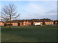
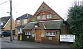
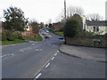
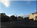
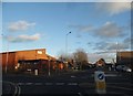
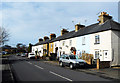
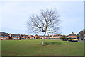
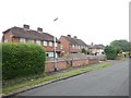
29 photos from this area
Area Information
Key information about the HP10 9UU including its size, population, and administrative classification.
- Area Type
- Postcode
- Area Size
- 2.1 hectares
- Population
- 1411
- Population Density
- 1933 people/km²
House Prices in HP10 9UU
32
Properties
£348,492
Average Sold Price
£106,000
Lowest Price
£570,000
Highest Price
Showing 32 properties
| Address | Type | Beds | Baths | Last Sale Price | Last Sale Date | |
|---|---|---|---|---|---|---|
| 41 Norwood Road, Loudwater, HP10 9UU | Semi-detached | 4 | 3 | £570,000 | Jan 2025 | |
| 57 Norwood Road, Loudwater, HP10 9UU | Semi-detached | 3 | 2 | £525,000 | Feb 2024 | |
| 59 Norwood Road, Loudwater, HP10 9UU | Retail | 3 | 2 | £475,000 | Nov 2022 | |
| 9 Norwood Road, Loudwater, HP10 9UU | Semi-detached | 3 | 2 | £478,000 | Jun 2022 | |
| 47 Norwood Road, Loudwater, HP10 9UU | house | - | - | £435,000 | Sep 2021 | |
| 43 Norwood Road, Loudwater, HP10 9UU | house | - | - | £520,000 | Aug 2021 | |
| 51 Norwood Road, Loudwater, HP10 9UU | Semi-detached | - | - | £400,000 | Aug 2020 | |
| 11 Norwood Road, Loudwater, HP10 9UU | Semi-detached | 3 | 1 | £391,000 | May 2020 | |
| 23 Norwood Road, Loudwater, HP10 9UU | house | - | - | £445,000 | Jun 2019 | |
| 17 Norwood Road, Loudwater, HP10 9UU | Semi-detached | 3 | 1 | £333,000 | Aug 2018 |
Page 1 of 4
Energy Efficiency in HP10 9UU
Amenities
Schools
| Rank | School | Type | Entry gender | Ages |
|---|
Explore more schools in this area
Go to Schools tabDemographics
Household Size
One person
most common
Accommodation Type
Houses
most common
Tenure
66
majority
Ethnic Group
White
most common
Religion
N/A
most common
Household Composition
N/A
most common
Age
47
median
Adults (30-64 years)
most common
Household Deprivation
N/A
with no deprivation
NS-SEC
37
in Lower managerial occupations
Explore more demographic insights in this area
Go to Demographics tabPlanning
Planning Constraints
- Flood RiskPremium
- Ramsar Wetland SitesPremium
- Area of Outstanding Natural BeautyPremium
- Protected Nature ReservePremium
- Protected WoodlandPremium