Area Overview for HP10 9UF
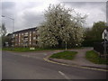
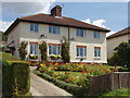
Photos of HP10 9UF


Area Information
HP10 9UF is a compact residential postcode in England, home to 1,407 people spread across a densely populated area of 659 people per square kilometre. This small cluster of homes is characterised by a mature demographic, with a median age of 47 and a majority of residents aged 30–64. The area’s housing stock is predominantly owner-occupied, with 77% of homes owned by their residents. Daily life here is shaped by proximity to essential services, including five retail outlets such as Morrisons Daily and Sainsburys Flackwell Heath, and easy access to rail networks. The postcode lies near Bourne End and High Wycombe railway stations, offering connections to London and surrounding towns. While the community is small, it benefits from practical amenities and a stable infrastructure, making it a viable choice for those seeking a settled, low-maintenance lifestyle. The area’s compact size means it is well-suited to those prioritising convenience over sprawling suburban sprawl, though its limited scale may restrict options for those needing larger properties.
- Area Type
- Postcode
- Area Size
- Not available
- Population
- 1407
- Population Density
- 659 people/km²
The property market in HP10 9UF is dominated by owner-occupied homes, with 77% of properties owned by their residents. This contrasts with areas where rental demand drives the market, suggesting a community focused on long-term investment rather than short-term tenancy. The accommodation type is predominantly houses, which aligns with the area’s small scale and compact layout. Given the postcode’s limited size, the housing stock is unlikely to be extensive, which could mean fewer options for buyers seeking specific property types. The high home ownership rate also implies a stable market, with properties likely retaining value due to the area’s established character. However, the small footprint of HP10 9UF means buyers should consider nearby areas for broader choices, particularly if seeking larger homes or alternative housing styles.
House Prices in HP10 9UF
No properties found in this postcode.
Energy Efficiency in HP10 9UF
Living in HP10 9UF offers access to a range of practical amenities within short distances. The area is served by five retail outlets, including Morrisons Daily, Tesco High, and Sainsburys Flackwell Heath, ensuring everyday shopping needs are met. Nearby rail stations such as Bourne End and High Wycombe provide convenient links to major towns and cities, while Wycombe Air Park adds a unique touch to the local transport landscape. Though the area is small, its proximity to these services suggests a lifestyle focused on convenience rather than sprawling leisure options. The presence of multiple supermarkets and rail connections implies a community prioritising accessibility, though residents may need to travel further for more specialised amenities. The compact nature of HP10 9UF means daily life is efficient, with minimal need for long commutes or extensive travel.
Amenities
Schools
| Rank | School | Type | Entry gender | Ages |
|---|
Explore more schools in this area
Go to Schools tabDemographics
The population of HP10 9UF is predominantly adults aged 30–64, with a median age of 47. This suggests a community of established professionals and families, likely with strong ties to local employment and services. Home ownership is high at 77%, indicating a stable, long-term resident base rather than a transient rental market. The accommodation type is primarily houses, reflecting a preference for private, detached living. The predominant ethnic group is White, though no specific data on diversity or deprivation is provided. The age profile and ownership rates imply a low turnover of properties, which can stabilise local property values but may also limit opportunities for first-time buyers. The absence of data on deprivation or minority groups means the area’s social dynamics remain largely unexplored in this context.
Household Size
Accommodation Type
Tenure
Ethnic Group
Religion
Household Composition
Age
Household Deprivation
NS-SEC
Explore more demographic insights in this area
Go to Demographics tabPlanning
Planning Constraints
- Flood RiskPremium
- Ramsar Wetland SitesPremium
- Area of Outstanding Natural BeautyPremium
- Protected Nature ReservePremium
- Protected WoodlandPremium