Area Overview for HP10 9UD
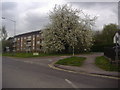
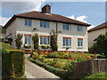
Photos of HP10 9UD


Area Information
HP10 9UD is a small residential postcode area in England, covering 2,984 square metres and home to 1,407 residents. Its compact size means it is a tightly knit community, with a population density of 659 people per square kilometre. This area is distinct for its mix of mature residents, with a median age of 47, and a strong presence of adults aged 30–64. Daily life here is shaped by proximity to nearby towns and a blend of local amenities. The area’s small footprint ensures a quiet, residential character, though it remains well-connected to surrounding regions via rail and road. Residents benefit from a balance of privacy and accessibility, with homes predominantly in single-family properties. The postcode’s limited size means it is best viewed as part of a broader regional context, offering a snapshot of suburban living in a defined, manageable space.
- Area Type
- Postcode
- Area Size
- 2984 m²
- Population
- 1407
- Population Density
- 659 people/km²
The property market in HP10 9UD is characterised by a high rate of home ownership (77%), with houses making up the majority of accommodation types. This indicates a market skewed towards owner-occupied properties rather than rentals, suggesting a preference for long-term investment in residential homes. The small size of the area means the housing stock is limited, with few new developments likely to emerge. Buyers should consider nearby postcode areas for a broader selection, though HP10 9UD itself offers a compact, established residential offering. The prevalence of houses may appeal to families seeking space and privacy, though the limited supply could make competition for properties intense. Prospective buyers should view this area as part of a regional network, leveraging its proximity to larger towns for additional options.
House Prices in HP10 9UD
No properties found in this postcode.
Energy Efficiency in HP10 9UD
Living in HP10 9UD offers access to a range of amenities within easy reach. Retail options include major supermarkets such as Morrisons Daily, Tesco High, and Sainsburys Flackwell Heath, ensuring daily shopping needs are met. The area’s rail stations—Bourne End, Beaconsfield, and High Wycombe—provide seamless connections to surrounding regions, enhancing access to employment, culture, and services. While the data does not specify parks or leisure facilities, the presence of nearby airports and rail networks suggests a lifestyle balanced between suburban tranquillity and urban accessibility. The availability of multiple retail outlets and transport hubs contributes to a practical, convenient daily life, supporting both routine tasks and broader mobility.
Amenities
Schools
| Rank | School | Type | Entry gender | Ages |
|---|
Explore more schools in this area
Go to Schools tabDemographics
The community in HP10 9UD is predominantly composed of adults aged 30–64, with a median age of 47. This suggests a stable, mature population, likely with established careers and families. Home ownership is high, with 77% of residents owning their homes, indicating a long-term commitment to the area. The accommodation type is primarily houses, reflecting a preference for detached or semi-detached properties. The predominant ethnic group is White, though specific data on diversity or minority representation is not provided. The population density of 659 people per square kilometre implies a moderate level of urbanisation, with enough space to avoid overcrowding. This demographic profile suggests a community focused on stability, with a mix of professionals and families seeking a settled environment.
Household Size
Accommodation Type
Tenure
Ethnic Group
Religion
Household Composition
Age
Household Deprivation
NS-SEC
Explore more demographic insights in this area
Go to Demographics tabPlanning
Planning Constraints
- Flood RiskPremium
- Ramsar Wetland SitesPremium
- Area of Outstanding Natural BeautyPremium
- Protected Nature ReservePremium
- Protected WoodlandPremium