Area Overview for HP10 9RH
Photos of HP10 9RH
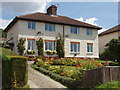
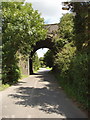
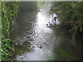
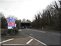


67 photos from this area
Area Information
Key information about the HP10 9RH including its size, population, and administrative classification.
- Area Type
- Postcode
- Area Size
- 1.9 hectares
- Population
- 1407
- Population Density
- 659 people/km²
House Prices in HP10 9RH
21
Properties
£354,917
Average Sold Price
£85,000
Lowest Price
£665,000
Highest Price
Showing 21 properties
| Address | Type | Beds | Baths | Last Sale Price | Last Sale Date | |
|---|---|---|---|---|---|---|
| 12 Derehams Lane, Loudwater, HP10 9RH | Bungalow | 4 | 2 | £665,000 | Feb 2025 | |
| 13A Derehams Lane, Loudwater, HP10 9RH | Bungalow | 2 | 2 | £300,000 | Nov 2022 | |
| Lamphey, Derehams Lane, Loudwater, HP10 9RH | Detached | 4 | 2 | £587,500 | Apr 2021 | |
| 13 Derehams Lane, Loudwater, HP10 9RH | Bungalow | - | - | £580,000 | Jul 2018 | |
| 10 Derehams Lane, Loudwater, HP10 9RH | Detached | 5 | 4 | £378,000 | Dec 2013 | |
| Dancing Ledge, 9 Derehams Lane, Loudwater, HP10 9RH | Detached | - | - | £310,000 | Oct 2009 | |
| 16 Derehams Lane, Loudwater, HP10 9RH | Detached | - | - | £200,000 | Nov 1999 | |
| 4 Derehams Lane, Loudwater, HP10 9RH | house | - | - | £88,750 | Aug 1997 | |
| 6 Derehams Lane, Loudwater, HP10 9RH | house | 2 | - | £85,000 | Apr 1997 | |
| 8A Derehams Lane, Loudwater, HP10 9RH | Bungalow | 3 | 2 | - | - |
Page 1 of 3
Energy Efficiency in HP10 9RH
Amenities
Schools
| Rank | School | Type | Entry gender | Ages |
|---|
Explore more schools in this area
Go to Schools tabDemographics
Household Size
Family (3-5 people)
most common
Accommodation Type
Houses
most common
Tenure
77
majority
Ethnic Group
White
most common
Religion
N/A
most common
Household Composition
N/A
most common
Age
47
median
Adults (30-64 years)
most common
Household Deprivation
N/A
with no deprivation
NS-SEC
39
in Lower managerial occupations
Explore more demographic insights in this area
Go to Demographics tabPlanning
Planning Constraints
- Flood RiskPremium
- Ramsar Wetland SitesPremium
- Area of Outstanding Natural BeautyPremium
- Protected Nature ReservePremium
- Protected WoodlandPremium