Area Overview for HP10 8JG
Photos of HP10 8JG
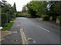
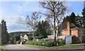
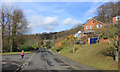
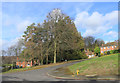
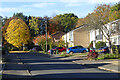
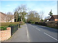
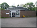

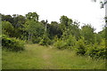
15 photos from this area
Area Information
Key information about the HP10 8JG including its size, population, and administrative classification.
- Area Type
- Postcode
- Area Size
- 3.8 hectares
- Population
- 1292
- Population Density
- 985 people/km²
House Prices in HP10 8JG
33
Properties
£742,331
Average Sold Price
£17,500
Lowest Price
£1,250,000
Highest Price
Showing 33 properties
| Address | Type | Beds | Baths | Last Sale Price | Last Sale Date | |
|---|---|---|---|---|---|---|
| 21 Southcote Way, Tylers Green, HP10 8JG | Detached | 5 | 2 | £999,000 | Jan 2025 | |
| 2 Southcote Way, Tylers Green, HP10 8JG | Detached | 5 | 2 | £1,250,000 | Apr 2024 | |
| 29 Southcote Way, Tylers Green, HP10 8JG | Retail | 5 | 2 | £990,000 | Apr 2023 | |
| 28 Southcote Way, Tylers Green, HP10 8JG | Retail | 5 | 2 | £1,210,000 | Nov 2022 | |
| 20 Southcote Way, Tylers Green, HP10 8JG | house | - | - | £1,150,000 | May 2022 | |
| 7 Southcote Way, Tylers Green, HP10 8JG | Detached | 5 | 3 | £17,500 | Jan 2017 | |
| 27 Southcote Way, Tylers Green, HP10 8JG | house | - | - | £765,000 | Nov 2013 | |
| 14 Southcote Way, Tylers Green, HP10 8JG | Detached | 5 | 2 | £772,500 | Jul 2013 | |
| 26 Southcote Way, Tylers Green, HP10 8JG | Detached | 5 | 2 | £795,000 | Jun 2013 | |
| 10 Southcote Way, Tylers Green, HP10 8JG | house | - | - | £865,000 | Dec 2011 |
Page 1 of 4
Energy Efficiency in HP10 8JG
Amenities
Schools
| Rank | School | Type | Entry gender | Ages |
|---|
Explore more schools in this area
Go to Schools tabDemographics
Household Size
Family (3-5 people)
most common
Accommodation Type
Houses
most common
Tenure
88
majority
Ethnic Group
White
most common
Religion
N/A
most common
Household Composition
N/A
most common
Age
47
median
Adults (30-64 years)
most common
Household Deprivation
N/A
with no deprivation
NS-SEC
54
in Lower managerial occupations
Explore more demographic insights in this area
Go to Demographics tabPlanning
Planning Constraints
- Flood RiskPremium
- Ramsar Wetland SitesPremium
- Area of Outstanding Natural BeautyPremium
- Protected Nature ReservePremium