Area Overview for HP10 8DJ
Photos of HP10 8DJ
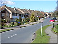
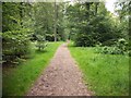
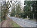
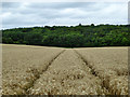
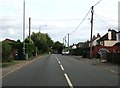
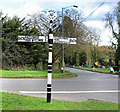
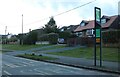
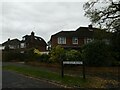
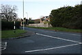
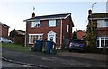
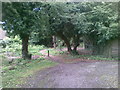

26 photos from this area
Area Information
Key information about the HP10 8DJ including its size, population, and administrative classification.
- Area Type
- Postcode
- Area Size
- 2.8 hectares
- Population
- 1439
- Population Density
- 946 people/km²
House Prices in HP10 8DJ
27
Properties
£484,165
Average Sold Price
£139,950
Lowest Price
£940,000
Highest Price
Showing 27 properties
| Address | Type | Beds | Baths | Last Sale Price | Last Sale Date | |
|---|---|---|---|---|---|---|
| Little Romney, 9A New Road, Tylers Green, HP10 8DJ | Semi-detached | 3 | 2 | £675,000 | Jul 2024 | |
| 13 New Road, Tylers Green, HP10 8DJ | Bungalow | - | - | £805,000 | Dec 2021 | |
| 5 New Road, Tylers Green, HP10 8DJ | house | 2 | 2 | £526,000 | Nov 2021 | |
| Radden Croft, 10 New Road, Tylers Green, HP10 8DJ | Detached | 4 | 4 | £940,000 | Mar 2021 | |
| 9 New Road, Tylers Green, HP10 8DJ | house | 2 | 1 | £552,500 | Jan 2021 | |
| 3, Fields End, New Road, Tylers Green, HP10 8DJ | Semi-detached | 2 | 1 | £333,000 | May 2019 | |
| 2, Fields End, New Road, Tylers Green, HP10 8DJ | Maisonette | - | - | £277,500 | Mar 2017 | |
| 28 New Road, Tylers Green, HP10 8DJ | Detached | 3 | - | £699,950 | Feb 2017 | |
| 19 New Road, Tylers Green, HP10 8DJ | Detached | 3 | 2 | £720,000 | Dec 2011 | |
| 11 New Road, Tylers Green, HP10 8DJ | Semi-detached | - | - | £260,000 | Sep 2009 |
Page 1 of 3
Energy Efficiency in HP10 8DJ
Amenities
Schools
| Rank | School | Type | Entry gender | Ages |
|---|
Explore more schools in this area
Go to Schools tabDemographics
Household Size
Family (3-5 people)
most common
Accommodation Type
Houses
most common
Tenure
91
majority
Ethnic Group
White
most common
Religion
N/A
most common
Household Composition
N/A
most common
Age
47
median
Adults (30-64 years)
most common
Household Deprivation
N/A
with no deprivation
NS-SEC
53
in Lower managerial occupations
Explore more demographic insights in this area
Go to Demographics tabPlanning
Planning Constraints
- Flood RiskPremium
- Ramsar Wetland SitesPremium
- Area of Outstanding Natural BeautyPremium
- Protected Nature ReservePremium
- Protected WoodlandPremium