Area Overview for HP10 0QR
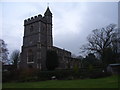
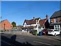
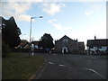
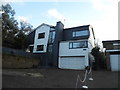
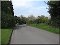
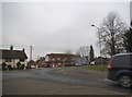
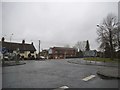
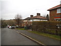
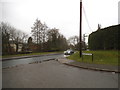
Photos of HP10 0QR

Area Information
Living in HP10 0QR offers a compact, residential experience shaped by its small cluster of homes and modest population of 1,478 people. The area’s density of 554 people per square kilometre suggests a tightly knit community, where daily life is likely characterised by familiarity and proximity to local amenities. As a postcode area, HP10 0QR is not expansive, but it is well-served by nearby infrastructure, including multiple railway stations and retail hubs. The demographic profile hints at a mature, stable population, with a median age of 47 and a majority of residents aged 30–64. This suggests a community rooted in long-term residency, with 85% of homes owner-occupied. While the area lacks large-scale features, its quiet, residential nature may appeal to those seeking a low-key, manageable environment with access to essential services within walking or short driving distance. The absence of major environmental constraints, such as protected woodlands or AONB designations, means development pressure is minimal, preserving the area’s straightforward, unpretentious character.
- Area Type
- Postcode
- Area Size
- Not available
- Population
- 1478
- Population Density
- 554 people/km²
The property market in HP10 0QR is dominated by owner-occupied homes, with 85% of properties in private hands. This high rate of home ownership suggests a community of long-term residents, many of whom may have purchased properties decades ago. The accommodation type is exclusively houses, which is unusual for areas with higher densities or more mixed housing stock. This implies a focus on standalone, possibly larger homes, which may appeal to those prioritising space and privacy. However, the small size of HP10 0QR means the housing stock is limited, and buyers may find fewer options compared to larger towns or cities. The immediate surroundings, such as nearby postcode areas, may offer additional choices, but the overall market remains constrained by the area’s compact nature. For buyers, this means a potential focus on established properties with limited new developments, though the absence of planning constraints like protected woodlands or AONB designations could make property transactions straightforward.
House Prices in HP10 0QR
No properties found in this postcode.
Energy Efficiency in HP10 0QR
Daily life in HP10 0QR is shaped by its proximity to retail and transport hubs. Nearby amenities include M&S Parade BP, Tesco Wooburn, and Tesco Bourne, offering essential shopping and services within easy reach. These stores cater to everyday needs, from groceries to fuel, reducing the necessity for long trips. The area’s rail network further enhances accessibility, with stations like Bourne End and Beaconsfield providing links to broader regional networks. While the data does not mention parks or leisure facilities, the absence of planning constraints such as protected woodlands or AONB designations suggests the area is free from restrictions on local development or recreational use. The combination of retail convenience and transport options creates a practical, low-stress environment, ideal for those prioritising ease of access over large-scale amenities.
Amenities
Schools
The nearest school to HP10 0QR is St Paul’s Church of England Combined School in Wooburn, which serves as a primary school with a good Ofsted rating. This single primary school is the only one listed in the data, meaning families in HP10 0QR rely on it for early education. As a combined school, it likely caters to multiple age groups, providing a convenient option for local children. The good Ofsted rating indicates a satisfactory standard of teaching and facilities, which is a positive for parents seeking reliable education. However, the absence of secondary schools or other educational institutions in the immediate area means families may need to travel further for secondary education. For those prioritising proximity to schools, St Paul’s offers a solid foundation, though the limited range of educational options could be a consideration for larger families or those requiring specialist provisions.
| Rank | School | Type | Entry gender | Ages |
|---|
Explore more schools in this area
Go to Schools tabDemographics
The community in HP10 0QR is predominantly composed of adults aged 30–64, reflecting a median age of 47. This suggests a population that is largely settled, with fewer young families or retirees compared to other areas. Home ownership is high at 85%, indicating a strong presence of long-term residents who have invested in property. The accommodation type is primarily houses, which aligns with the area’s small, residential nature and may contribute to a sense of privacy and space. The predominant ethnic group is White, though no specific data on diversity or deprivation is provided. The high home ownership rate implies a stable, low-turnover community, where residents are likely to have established roots. For those considering HP10 0QR, this demographic profile suggests a quiet, mature neighbourhood with limited rental availability, making it more suited to buyers seeking a permanent home rather than temporary housing.
Household Size
Accommodation Type
Tenure
Ethnic Group
Religion
Household Composition
Age
Household Deprivation
NS-SEC
Explore more demographic insights in this area
Go to Demographics tabPlanning
Planning Constraints
- Flood RiskPremium
- Ramsar Wetland SitesPremium
- Area of Outstanding Natural BeautyPremium
- Protected Nature ReservePremium
- Protected WoodlandPremium