Area Overview for HP10 0PT
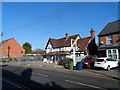
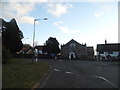
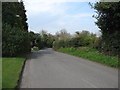
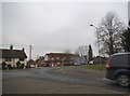
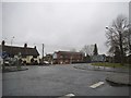
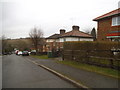
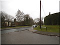
Photos of HP10 0PT


Area Information
Living in HP10 0PT offers a compact, residential experience shaped by its small cluster of homes and proximity to key services. With a population of 1,478 spread across 554 people per square kilometre, the area feels intimate yet functional. The community is anchored by a median age of 47, with most residents falling into the 30-64 age range. This suggests a stable, established demographic, likely with families and professionals seeking a quieter, low-density environment. Daily life here is defined by proximity to local amenities, including five retail outlets and multiple rail stations, which connect residents to nearby towns. The area’s compact size means residents can access essentials without long commutes, though its small footprint may limit the diversity of services compared to larger towns. The absence of major planning constraints or environmental designations also means development is unlikely to disrupt the existing character. For those prioritising safety, the area scores highly, with a crime risk score of 89/100, indicating a secure neighbourhood. HP10 0PT is ideal for buyers seeking a balanced mix of convenience, safety, and a close-knit community.
- Area Type
- Postcode
- Area Size
- Not available
- Population
- 1478
- Population Density
- 554 people/km²
The property market in HP10 0PT is characterised by high home ownership, with 85% of properties occupied by their owners. This suggests a stable, long-term resident base and limited rental activity, which can make the area less dynamic for investors but more predictable for buyers. The accommodation type is predominantly houses, reflecting the area’s low-density, residential nature. This contrasts with areas dominated by flats or apartments, which are more common in urban settings. The small size of HP10 0PT means the housing stock is likely limited to a few hundred properties, which could create a competitive market for buyers. The absence of major planning constraints or environmental designations also means new developments are unlikely to significantly alter the existing character. For buyers, this translates to a market where properties are likely to retain their value, but choices may be limited to the existing stock. The focus on owner-occupied homes also implies a community where residents are invested in maintaining local amenities and services.
House Prices in HP10 0PT
No properties found in this postcode.
Energy Efficiency in HP10 0PT
Residents of HP10 0PT have access to a range of local amenities within practical reach. Five retail outlets, including Tesco Wooburn and M&S Parade BP, provide essential shopping options, while nearby rail stations offer connections to broader networks. The presence of Wycombe Air Park adds a unique dimension for those requiring air travel. Though the area’s small size means services are concentrated, this also fosters a sense of community where residents can access daily needs without venturing far. The absence of major leisure or entertainment venues suggests a quieter, more residential lifestyle, with local amenities focused on practicality rather than luxury. For families, the proximity to St Paul’s Church of England Combined School ensures children can attend school without long commutes. Overall, the lifestyle in HP10 0PT is defined by convenience, accessibility, and a balance between simplicity and connectivity.
Amenities
Schools
The nearest school to HP10 0PT is St Paul’s Church of England Combined School in Wooburn, which serves both primary and secondary education. The school holds a ‘good’ Ofsted rating, indicating it meets national standards for teaching quality and student outcomes. This single school provides a comprehensive option for families in the area, though the lack of additional schools may mean students travel to nearby towns for higher education. The presence of a combined school suggests the area’s population is sufficient to support a single educational institution but may not cater to larger family needs. For parents, the school’s rating offers reassurance about the quality of education available without requiring long commutes. However, the absence of other schools in the immediate vicinity could be a limitation for those requiring multiple options, such as specialist provisions or alternative curricula.
| Rank | School | Type | Entry gender | Ages |
|---|
Explore more schools in this area
Go to Schools tabDemographics
The population of HP10 0PT is predominantly composed of adults aged 30-64, with a median age of 47. This suggests a mature, settled community where many residents may be in their prime working years or nearing retirement. Home ownership is high, at 85%, indicating a strong presence of long-term residents and a stable housing market. The accommodation type is primarily houses, which aligns with the area’s low density and residential character. The predominant ethnic group is White, which reflects the broader demographic trends in rural and semi-rural parts of England. While no specific data on deprivation is provided, the high home ownership rate and low crime risk suggest a relatively affluent or stable community. This demographic profile may appeal to buyers seeking a family-friendly environment with minimal turnover and a sense of permanence. The absence of detailed diversity statistics means the area’s social composition remains largely homogeneous, which could be a consideration for those prioritising cultural variety.
Household Size
Accommodation Type
Tenure
Ethnic Group
Religion
Household Composition
Age
Household Deprivation
NS-SEC
Explore more demographic insights in this area
Go to Demographics tabPlanning
Planning Constraints
- Flood RiskPremium
- Ramsar Wetland SitesPremium
- Area of Outstanding Natural BeautyPremium
- Protected Nature ReservePremium
- Protected WoodlandPremium