Area Overview for HP10 0LX
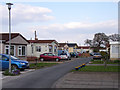
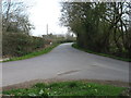
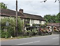
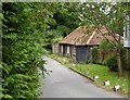
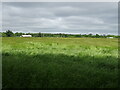
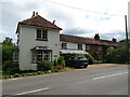
Photos of HP10 0LX


Area Information
Living in HP10 0LX means being part of a small, tightly knit residential cluster in England. With a population of 2,390 and a density of 213 people per square kilometre, the area feels intimate yet connected to broader networks. The community is characterised by a mature demographic, with a median age of 47 and a majority of residents aged 30–64. This suggests a stable population of professionals and families, many of whom own their homes. The area’s compact size means amenities and services are within practical reach, while its proximity to rail links and schools adds to its appeal. Daily life here balances quiet residential living with access to essential services, making it suitable for those seeking a balanced lifestyle without the pressures of larger urban centres. The presence of both state and independent schools reflects the area’s commitment to education, while the mix of retail and transport options ensures convenience for residents. HP10 0LX is a place where community ties are strong, and practicality meets comfort.
- Area Type
- Postcode
- Area Size
- Not available
- Population
- 2390
- Population Density
- 213 people/km²
The property market in HP10 0LX is dominated by owner-occupied homes, with 71% of properties owned by residents. The accommodation type is primarily houses, indicating a low-density, suburban character. This suggests a market that caters to families and individuals seeking permanent, stable housing rather than short-term rentals. The small size of the area means the housing stock is limited, which can drive competition among buyers. For those considering the area, the prevalence of houses may appeal to those prioritising space and privacy. However, the compact nature of HP10 0LX means the immediate surroundings are crucial for additional property options. Buyers should focus on proximity to amenities, schools, and transport links, as these are key factors in the area’s desirability. The high home ownership rate also implies a stable market, with fewer fluctuations compared to rental-heavy regions.
House Prices in HP10 0LX
No properties found in this postcode.
Energy Efficiency in HP10 0LX
The lifestyle in HP10 0LX is shaped by its proximity to retail, dining, and transport hubs. Nearby shops include Tesco Wooburn, Asda Holtspur, and M&S Beaconsfield M40 Moto SF, offering a range of everyday essentials. These retail options are within practical walking or driving distance, reducing the need for long commutes. The area’s rail stations, such as Bourne End and Beaconsfield, provide easy access to public transport, enhancing connectivity to larger centres. While parks and leisure facilities are not explicitly listed in the data, the presence of schools and retail suggests a balance between residential tranquillity and community amenities. The mix of shops and transport links ensures daily life is convenient, with options for shopping, commuting, and accessing services without leaving the immediate vicinity.
Amenities
Schools
Residents of HP10 0LX have access to a range of schools, including state and independent options. Primary schools in the area include Dorney School, St Nicolas’ Church of England Combined School, and Silchester House School and Silchester Manor School, both of which are independent. St Nicolas’ Church of England Combined School is also listed as an academy with a ‘good’ Ofsted rating. This mix of school types provides families with choices, from state-funded institutions to private education. The presence of an academy with a ‘good’ rating suggests at least one school meets or exceeds national standards in teaching and outcomes. For parents, this diversity ensures options for different educational philosophies and budgets. The proximity of these schools to homes in HP10 0LX makes the area attractive for families prioritising quality education.
| Rank | School | Type | Entry gender | Ages |
|---|
Explore more schools in this area
Go to Schools tabDemographics
The community in HP10 0LX is predominantly composed of adults aged 30–64, with a median age of 47. This indicates a population skewed towards middle-aged individuals, likely including professionals, families, and retirees. Home ownership is high, at 71%, suggesting a stable, long-term resident base. The accommodation type is primarily houses, reflecting a more traditional, low-density housing stock. The predominant ethnic group is White, though specific data on diversity is not provided. The age profile implies a community with established roots, where families may be raising children in the area’s schools. With 71% of homes owned by residents, the area is less reliant on rental markets, which can influence property values and local dynamics. The demographic makeup suggests a focus on stability and long-term residency, with fewer transient populations compared to more urban areas.
Household Size
Accommodation Type
Tenure
Ethnic Group
Religion
Household Composition
Age
Household Deprivation
NS-SEC
Explore more demographic insights in this area
Go to Demographics tabPlanning
Planning Constraints
- Flood RiskPremium
- Ramsar Wetland SitesPremium
- Area of Outstanding Natural BeautyPremium
- Protected Nature ReservePremium
- Protected WoodlandPremium