Area Overview for HP10 0LT
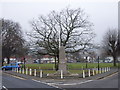
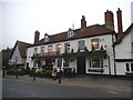
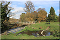
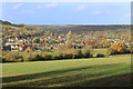
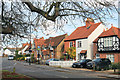
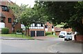
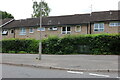
Photos of HP10 0LT


Area Information
HP10 0LT is a small, compact residential postcode in England, home to 2020 residents spread across a densely populated area of 1642 people per square kilometre. This cluster of homes is characterised by its quiet, established charm, with a majority of residents aged 30–64, suggesting a community of long-term locals and families. The area’s size means it is not sprawling but tightly knit, with daily life revolving around nearby amenities and green spaces. With 72% of homes owned by residents, HP10 0LT is a place where people stay put, fostering a sense of stability. The presence of two primary schools, including Wooburn Green Primary School with a ‘good’ Ofsted rating, ensures families have access to quality education. Proximity to rail networks and retail hubs like Tesco Wooburn adds to its practical appeal. Living here means balancing a compact, community-focused environment with easy access to essential services, making it a viable choice for those seeking a settled, low-maintenance lifestyle.
- Area Type
- Postcode
- Area Size
- Not available
- Population
- 2020
- Population Density
- 1642 people/km²
The property market in HP10 0LT is dominated by owner-occupied homes, with 72% of properties owned by residents rather than rented. The accommodation type is predominantly houses, which is unusual for areas with higher rental activity. This suggests a community of settled families and individuals who have invested in long-term living. The small size of the postcode means the housing stock is limited, with fewer new developments likely to alter the character of the area. Buyers should consider the compact nature of HP10 0LT, as properties are likely to be in established, older stock rather than modern builds. The high home ownership rate also indicates strong local demand, which could affect price stability. For those seeking a home in this area, the focus is on acquiring a house in a mature, low-risk environment rather than a speculative rental market.
House Prices in HP10 0LT
No properties found in this postcode.
Energy Efficiency in HP10 0LT
The lifestyle in HP10 0LT is shaped by its proximity to practical amenities, including retail hubs like Tesco Wooburn and Asda Holtspur, which cater to everyday shopping needs. The area’s rail stations—Bourne End, Beaconsfield, and Cookham—offer seamless connections to broader transport networks, enhancing mobility for both work and leisure. Nearby, Wycombe Air Park provides a unique local aviation amenity. The compact nature of the postcode means residents can access these services without lengthy journeys. The presence of two primary schools and a mix of retail and transport options contributes to a self-contained, convenient lifestyle. While the area lacks large-scale leisure facilities, its strategic location ensures that residents can easily reach larger centres for additional activities, blending local convenience with regional accessibility.
Amenities
Schools
Residents of HP10 0LT have access to two primary schools: The Meadows School and Wooburn Green Primary School, which holds a ‘good’ Ofsted rating. These institutions serve the local community, providing education for young children in a setting that prioritises primary-level learning. The presence of two primary schools within proximity means families have options, though no secondary schools are listed in the data. This suggests that students may need to travel to nearby towns for secondary education. The quality of Wooburn Green Primary School, in particular, offers reassurance for parents seeking a reliable start to their children’s schooling. The mix of schools reflects a focus on early education, which aligns with the area’s demographic of families with school-age children.
| Rank | School | Type | Entry gender | Ages |
|---|
Explore more schools in this area
Go to Schools tabDemographics
The population of HP10 0LT is predominantly adults aged 30–64, with a median age of 47, reflecting a mature, stable community. Home ownership is high at 72%, indicating a strong presence of long-term residents rather than transient renters. The area is largely composed of houses, which aligns with the demographic profile of established households. The predominant ethnic group is White, though specific data on diversity or deprivation is not provided. The age range suggests a mix of middle-aged professionals and families, with fewer younger or older residents. This profile may influence local services and amenities, which are tailored to the needs of adults and school-age children. The absence of detailed diversity statistics means the community’s cultural makeup remains less defined, but the high home ownership rate implies a cohesive, low-turnover environment.
Household Size
Accommodation Type
Tenure
Ethnic Group
Religion
Household Composition
Age
Household Deprivation
NS-SEC
Explore more demographic insights in this area
Go to Demographics tabPlanning
Planning Constraints
- Flood RiskPremium
- Ramsar Wetland SitesPremium
- Area of Outstanding Natural BeautyPremium
- Protected Nature ReservePremium
- Protected WoodlandPremium