Area Overview for HP10 0HN
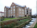
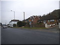
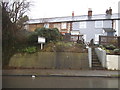
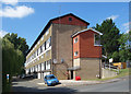
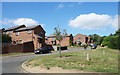
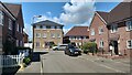
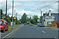
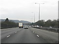
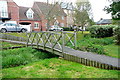
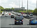
Photos of HP10 0HN


Area Information
HP10 0HN is a small, tightly packed residential cluster in England, home to 2020 people spread across a densely populated area. With a population density of 1642 people per square kilometre, this postcode reflects a compact, community-oriented layout. The area is characterised by a mature demographic, with a median age of 47 and a strong presence of adults aged 30–64. This suggests a stable, established population, likely comprising professionals and families seeking a quiet, well-connected environment. Daily life here is shaped by proximity to local amenities, including retail hubs like Tesco Wooburn and Asda Holtspur, and easy access to rail networks such as Bourne End and Beaconsfield stations. The area’s small size means residents are close to schools, green spaces, and transport links, making it practical for those prioritising convenience without sacrificing space. While the housing stock is dominated by owner-occupied homes, the mix of retail, transport, and educational facilities ensures a balanced lifestyle for those who live here.
- Area Type
- Postcode
- Area Size
- Not available
- Population
- 2020
- Population Density
- 1642 people/km²
The property market in HP10 0HN is dominated by owner-occupied homes, with 72% of residents living in properties they own. This high rate of home ownership suggests a stable, long-term population rather than a rental market. The accommodation type is primarily houses, which is typical for smaller, established residential areas. This focus on owner-occupied housing may make the area less appealing to renters seeking short-term solutions but could be advantageous for buyers looking for a place to settle permanently. The small size of the postcode means the housing stock is limited, so buyers may need to consider nearby areas for more options. The prevalence of houses also implies a preference for private, family-oriented living, which aligns with the area’s mature demographic. For those prioritising security and community ties, HP10 0HN’s property market offers a reliable, low-risk investment.
House Prices in HP10 0HN
No properties found in this postcode.
Energy Efficiency in HP10 0HN
The lifestyle in HP10 0HN is shaped by its proximity to practical amenities, including retail, transport, and leisure options. Local shops such as Tesco Wooburn, Tesco High, and Asda Holtspur provide everyday convenience, while nearby rail stations like Bourne End and Beaconsfield offer easy access to broader networks. The presence of Wycombe Air Park adds a layer of flexibility for travel. While the area lacks detailed information on parks or leisure facilities, the mix of retail and transport hubs suggests a focus on functionality over expansive recreational spaces. Residents benefit from a compact, efficient setup where daily needs are met without long commutes. The balance of shopping, transport, and occasional air travel makes HP10 0HN suitable for those prioritising practicality and connectivity in their lifestyle.
Amenities
Schools
Residents of HP10 0HN have access to two primary schools within practical reach: The Meadows School and Wooburn Green Primary School. Both institutions cater to younger children, providing essential early education. Wooburn Green Primary School holds an Ofsted rating of ‘good’, which is a positive indicator for families seeking quality education. The presence of two primary schools suggests a focus on family-friendly infrastructure, though secondary school options are not listed in the data. For parents prioritising primary education, the availability of two schools with a strong rating offers flexibility and reassurance. The compact nature of the area ensures that children can reach these schools without long commutes, supporting a balanced lifestyle for families.
| Rank | School | Type | Entry gender | Ages |
|---|
Explore more schools in this area
Go to Schools tabDemographics
The community in HP10 0HN is predominantly composed of adults aged 30–64, reflecting a mature, settled population. With a median age of 47, the area is less focused on younger families or retirees, instead attracting professionals and long-term residents. Home ownership is high at 72%, indicating a strong presence of long-term residents who have invested in property. The accommodation type is primarily houses, which aligns with the area’s residential character and suggests a preference for more spacious living compared to flats. The predominant ethnic group is White, which shapes the cultural and social fabric of the neighbourhood. While no specific deprivation data is provided, the high home ownership rate and stable age profile suggest a relatively secure economic environment. This demographic profile positions HP10 0HN as a place where stability and community cohesion are prioritised over rapid change or transient populations.
Household Size
Accommodation Type
Tenure
Ethnic Group
Religion
Household Composition
Age
Household Deprivation
NS-SEC
Explore more demographic insights in this area
Go to Demographics tabPlanning
Planning Constraints
- Flood RiskPremium
- Ramsar Wetland SitesPremium
- Area of Outstanding Natural BeautyPremium
- Protected Nature ReservePremium
- Protected WoodlandPremium