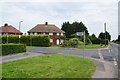
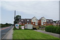
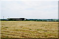
Area Overview for Hersden
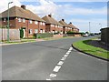
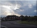
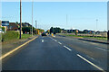
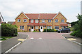
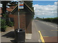
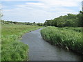
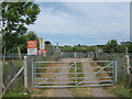
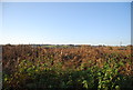
Photos of Hersden
Area Information
Living in Hersden offers a compact, well-connected environment within a 1.0 km² area. The town’s demographic profile is shaped by a median age of 70, suggesting a community with a significant proportion of older residents. This is reflected in the 76% home ownership rate, indicating a settled population. Daily life here is anchored by nearby amenities, including five retail outlets such as Co-op Sturry and M&S Maybrook, alongside rail access to Sturry, Bekesbourne, and Herne Bay stations. The area’s proximity to schools like Spires Academy and Water Meadows Primary School makes it appealing for families. Hersden’s low crime risk, with a safety score of 71, adds to its appeal as a secure place to live. While the town is small, its infrastructure supports practical living, with broadband and mobile connectivity rated at 87 and 84 respectively. This blend of safety, accessibility, and essential services positions Hersden as a viable option for those seeking a quiet, well-serviced location.
- Area Type
- Built Up Area 250
- Area Size
- 1.0 km²
- Population
- Not available
- Population Density
- Not available
Hersden’s lifestyle is shaped by its accessible amenities, including five retail outlets such as Co-op Sturry and Iceland Stour RP, offering everyday shopping convenience. The rail stations at Sturry, Bekesbourne, and Herne Bay provide links to broader transport networks, while the area’s compact size ensures that essential services are within walking or short driving distance. Although specific parks or leisure facilities are not detailed in the data, the presence of schools and retail options suggests a community-oriented environment. The blend of local shops and transport connections supports a practical, low-stress lifestyle, ideal for those prioritising ease of access over large-scale leisure options.
Amenities
Schools
Hersden is served by a range of educational institutions, including primary schools and an academy. Hersden Community Primary School and Montgomery School cater to younger children, while Spires Academy, rated ‘good’ by Ofsted, and Water Meadows Primary School, also rated ‘good’, provide options for primary education. The presence of both traditional primary schools and an academy suggests a diverse educational landscape, offering families choices between established institutions and potentially more specialist provision. For parents, the ‘good’ Ofsted ratings indicate that local schools meet acceptable standards, though specific curricular details are not provided. The proximity of these schools to residential areas enhances Hersden’s appeal, particularly for families seeking a reliable education system without long commutes.
| Rank | A + A* % | School | Type | Entry gender | Ages |
|---|---|---|---|---|---|
| 1 | N/A | Hersden Community Primary School | primary | N/A | N/A |
| 2 | N/A | Montgomery School | primary | N/A | N/A |
| 3 | N/A | Spires Academy | academy | N/A | N/A |
| 4 | N/A | Water Meadows Primary School | primary | N/A | N/A |
Explore more schools in this area
Go to Schools tabDemographics
Hersden’s population is predominantly older, with a median age of 70. This suggests a community where retirees and long-term residents form the majority. The 76% home ownership rate indicates that most households are owner-occupied, which may reflect the area’s stability. Household composition and accommodation types are not specified in the data, but the overall profile points to a mature demographic. The absence of specific figures on diversity or deprivation means the community’s social fabric remains less defined. However, the low crime risk score of 71 implies a generally safe environment, which aligns with the characteristics of an older, settled population. For residents, this translates to a quiet, low-maintenance lifestyle with minimal external pressures. The area’s infrastructure appears tailored to meet the needs of its primary demographic, though younger families may find fewer targeted amenities.
Household Size
Accommodation Type
Tenure
Ethnic Group
Religion
Household Composition
Age
Household Deprivation
NS-SEC
Explore more demographic insights in this area
Go to Demographics tabPlanning
Planning Constraints
- Crime RiskLocked