Area Overview for Herne
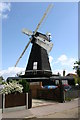
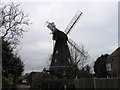
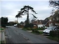
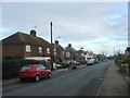
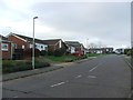
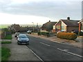
Photos of Herne

Area Information
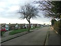
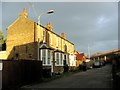
Herne is a compact built-up area covering just 2.0 km² in Kent. You are stepping into a residential neighbourhood defined by its scale rather than sprawling urbanity. Living in Herne means dealing with a tightly knit environment where every house and public space is within close proximity to your daily destinations. This area functions as a quiet extension of the broader coastal community, offering a sense of privacy that larger cities cannot match. The setting is established, free from the volatility of new development rushes. Residents here enjoy a defined local identity rooted in stability. Daily life unfolds at a steadier pace compared to major commercial hubs. You will find yourself surrounded by premises that have served the local population for generations. The area avoids the stark congestion typical of wider urban zones. Instead, you benefit from a streamlined layout that prioritises pedestrian comfort. Homes in Herne provide a backdrop of consistent character. This environment suits those who value locality without sacrificing essential access to wider transport networks. Whether you are walking to the station or visiting a corner shop, your journey remains short and predictable. This area represents a settled choice for buyers seeking a specific, manageable slice of English coastal life.
- Area Type
- Built Up Area 250
- Area Size
- 2.0 km²
- Population
- Not available
- Population Density
- Not available
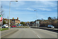
Your daily lifestyle in Herne is defined by convenience and practical access to essential services. You have five major retail outlets within practical reach that form the backbone of your weekly shopping. Co-op Eddington, Sainsburys Margate, and Tesco Herne are the notable venues you will frequent. These locations cover your needs for groceries and household essentials without requiring a long drive. You can complete your shopping trips locally with confidence. This retail density supports a self-sufficient daily routine. Travel to these destinations is simplified by the area's five railway connections. Herne Bay Railway Station serves as a primary commuter link. Chestfield & Swalecliffe Railway Station and Sturry Railway Station offer alternative routes for different schedules. This variety ensures you are not restricted to a single transport corridor. The combination of nearby supermarkets and multiple rail access points creates a functional lifestyle. You do not have to compromise on convenience for the sake of a quiet home. Dining options and leisure facilities are embedded within the reach of these main transport arteries. This accessibility allows you to maintain a work-life balance while staying close to home. The area supports a routine that feels both spacious and connected.
Amenities
Schools
Families seeking education options have solid local provision within Herne. You have two primary choices located directly in the vicinity. The Herne Church of England Infant and Nursery School holds an outstanding Ofsted rating. The Herne Church of England Junior School also carries an outstanding Ofsted rating. Both institutions operate under the same academic umbrella and share the highest possible government assessment grade. This dual setup provides a complete primary education pathway for young children without requiring travel outside the neighbourhood. The consistency of these ratings indicates a high standard of teaching and management across the primary phase. For families with children in the birth-to-age-11 bracket, this combination offers exceptional convenience. You do not need to commute to distant academies for your child's early education. The presence of two separate but linked institutions allows for specialized age-group teaching environments. This configuration supports a seamless transition between early years and lower primary schooling. While secondary data is absent from this section, the local infrastructure clearly prioritises quality early learning. If you are moving in with school-aged children, the local school performance data presents a very positive prospect.
| Rank | School | Type | Entry gender | Ages |
|---|
Explore more schools in this area
Go to Schools tabDemographics
The community in Herne reflects a demographic profile dominated by long-term residents. You will find that the population is ageing, with a median age of 70. This indicates that the neighbourhood attracts or retains residents in their later years. The most common age range suggests a retirement-oriented household structure. Home ownership stands at an impressive 82% based on the total population. This high figure signifies that the majority of families have already completed their financial climb into property. You can expect very few private rental properties within your immediate vicinity. The area does not display a diverse breakdown of household compositions beyond the aggregate total. Similarly, data regarding predominant ethnic groups and religious affiliations remains unavailable in the provided records. These gaps do not diminish the quality of life but reflect the specific statistical reporting for this zone. You are entering an area where financial independence is common, evidenced by the ownership rate. The lack of private rentals implies a stable, term-owner population. Deprivation metrics are not listed here, so you must evaluate quality of life based on access to amenities and infrastructure rather than indexed poverty scores. This sociological snapshot paints a picture of a financially secure but older populace focused on stability.
Household Size
Accommodation Type
Tenure
Ethnic Group
Religion
Household Composition
Age
Household Deprivation
NS-SEC
Explore more demographic insights in this area
Go to Demographics tabPlanning
Planning Constraints
- Crime RiskPremium