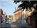
Area Overview for Henley-on-Thames
Photos of Henley-on-Thames


Area Information
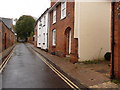
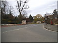
Living in Henley-on-Thames offers a distinct experience within a compact built-up area. This town covers just 4.2 square kilometres, creating an environment where residents move quickly between locations. The population numbers 1,595 people, resulting in a population density of 375 people per square kilometre. This density creates a neighbourhood that feels established without the congestion of a major city. You will find that daily life revolves around a central location where services and homes are close together. The area functions as a cohesive community unit rather than a sprawling district. Homes in Henley-on-Thames benefit from proximity to local amenities while maintaining a peaceful setting. The small size means you know exactly what surrounds your property. Every square metre of this built-up zone contributes to the character of the town. Whether you walk to a shop or take a short ride, the distance remains manageable. This layout suits those who prefer convenience alongside a sense of place. The distinction of the area lies in its size and the tight knit feel it generates for those choosing to reside here.
- Area Type
- Built Up Area 250
- Area Size
- 4.2 km²
- Population
- 1595
- Population Density
- 375 people/km²
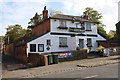
Residential areas within Henley-on-Thames offer practical access to retail and transport hubs. Five notable retail venues operate within practical reach, including Cook Henley-on, Sainsburys Henley, and Waitrose Henley-on. These locations provide everyday shopping needs without requiring long journeys. You can also access five nearby rail stations that serve the wider network. Henley, Shiplake Railway Station, and Wargrave Railway Station act as key interchange points for commuters. The concentration of rail links means you do not need a private car for regional travel. Retail choice includes both general grocery stores and food retailers. Five facilities serve the immediate transport needs of locals. The availability of Sainsburys and Waitrose indicates a range of price points and product choices. Cook Henley-on likely offers dining or boutique options alongside the supermarkets. The combination of shops and rail connections creates a self-sufficient lifestyle. You will find that a day's needs are met by the local streets.
Amenities
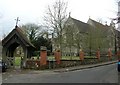
Schools
Families residing in Henley-on-Thames have access to several educational institutions nearby. Valley Road School operates as a primary school with a good Ofsted rating. Trinity Church of England Primary School, Henley-on-Thames also holds a good Ofsted rating. Sacred Heart Catholic Primary School, Henley-on-Thames completes the list of rated primary options with a good status. Badgemore Primary School serves as another primary option without a specific rating currently attached to the data. Henley Valley Road Nursery School provides early years education for younger children. The mix includes both voluntary aided and standard provision schools. You will find that primary education options are concentrated within walking distance of many homes. The presence of multiple primaries reduces the need for out-of-area travel. Although secondary schools are not listed in the current dataset, the primary sector offers varied choices. Good ratings at two institutions suggest a generally high standard of early education. The presence of a nursery supports parents with pre-kindergarten needs.
| Rank | A + A* % | School | Type | Entry gender | Ages |
|---|---|---|---|---|---|
| 1 | N/A | Henley Valley Road Nursery School | nursery | N/A | N/A |
| 2 | N/A | Valley Road School | primary | N/A | N/A |
| 3 | N/A | Badgemore Primary School | primary | N/A | N/A |
| 4 | N/A | Trinity Church of England Primary School | primary | N/A | N/A |
| 5 | N/A | Sacred Heart Catholic Primary School, Henley-on-Thames | primary | N/A | N/A |
Explore more schools in this area
Go to Schools tabDemographics
The community profile in Henley-on-Thames reflects a settled population with specific characteristics. Sixty-eight percent of households own their homes, indicating a stable residential base. The median age is 70, which suggests the area attracts older residents. Most common age ranges align with this higher average, pointing towards a retirement or later-life demographic. Accommodation types support this profile, though specific splits between houses and flats are not detailed in the current records. The household composition generally supports single-person or couple living given the age profile. Deprivation levels are not measured in the available data, but the high home ownership rate points to financial stability among residents. Diversity metrics are not broken down in the provided information, yet the town functions as a single community unit. You should expect a neighbourhood where long-term residents dominate the social landscape. The age structure means family life may focus more on raising grandchildren or leisure than raising young children. Homeownership figures confirm that buying a property in Henley-on-Thames secures your status as part of this established group. The demographic makeup remains consistent with the area's overall character of stability.
Household Size
Accommodation Type
Tenure
Ethnic Group
Religion
Household Composition
Age
Household Deprivation
NS-SEC
Explore more demographic insights in this area
Go to Demographics tabPlanning
Planning Constraints
- Crime RiskLocked