Area Overview for Haywards Heath
Photos of Haywards Heath


Area Information
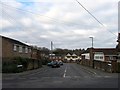
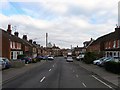
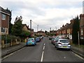
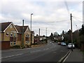
Haywards Heath sits as a built-up area within East Sussex, England, covering ten square kilometres. The town holds a population of 10,866 people, resulting in a population density of 1,055 individuals per square kilometre. This density reflects a residential community where homes cluster closely together while retaining the structure of a distinct town. Living in Haywards Heath means accessing a community that is dense enough for convenience yet situated within a built-up framework typical of the region. The area operates as a functional neighbourhood where local infrastructure serves a substantial number of residents across this relatively compact footprint. You can find a total homeowner base of seven in every ten people, indicating that the majority of the population owns their property outright or through a mortgage. Daily life here revolves around practical access to local services, with retail options and transport links positioned within practical reach of every home. The character of the area is defined by this concentration of people and the established nature of its overland transport connections.
- Area Type
- Built Up Area 250
- Area Size
- 10.3 km²
- Population
- 10866
- Population Density
- 1055 people/km²
Living in Haywards Heath offers direct access to five retail outlets and three key railway stations within practical reach. You can shop at Morrisons Daily Haywards, M&S Haywards, and Tesco Haywards without needing to travel far beyond the local town centre. For commuting or regional travel, Haywards Heath Railway Station, Wivelsfield Railway Station, and Burgess Hill Railway Station provide essential rail connectivity. Day trips or excursions beyond the immediate town are facilitated by two metro connections at Horsted Keynes and Sheffield Park. This network of amenities creates a lifestyle where daily necessities and external travel requirements are met efficiently. You will find that dining options, leisure facilities, and general services are anchored by these specific retail and transport nodes. The convenience of having three railway stations nearby distinguishes the area from other towns of similar size. This amenity density supports a lifestyle where you can manage most of your weekly requirements through local access points.
Amenities
Schools
Families considering Haywards Heath have access to a specific cluster of educational institutions within the town and its immediate vicinity. You can find five primary schools operating near the area, including Heyworth Primary School, which serves the early years of education. Lindfield Junior School and Lindfield Infant School operate as part of the local chain, providing separate infant and junior education stages. Harlands Primary School and Blackthorns Community Primary School, located in Lindfield, also feed into the local educational catchment. All five designated primary schools focus on early through lower secondary education, meaning you will not find comprehensive or secondary schools listed in the immediate provided data. The concentration of primary schools indicates a strong infrastructure for young children, though the lack of listed secondary options suggests you would need to look further afield for older children's education. This school mix defines the educational landscape for younger residents living in the town.
| Rank | School | Type | Entry gender | Ages |
|---|
Explore more schools in this area
Go to Schools tabDemographics
The community in Haywards Heath displays a median age of 70 years, marking a distinctly older demographic profile. This age figure suggests the area attracts retirees or long-term residents who have established roots in the town. Home ownership stands at 71 per cent, confirming that the most common household type involves owners rather than tenants. You will find that accommodation is primarily occupied by those who have secured a property title in their name. The age range data indicates that total population statistics drive the demographic picture, with no specific skew towards younger families or young professionals. While specific ethnicity and religion data are not provided for this location, the primary characteristic is the maturity of the resident base. This demographic shape often correlates with communities that prioritise quiet residential streets and established services over nightlife. You can expect a stable environment where the majority of households consist of homeowners managing properties across the built-up area.