Area Overview for Hawley (Hart)
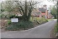
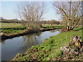
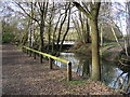
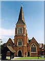
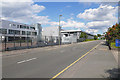
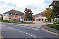
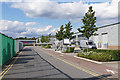
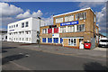
Photos of Hawley (Hart)
Area Information
Hawley (Hart) is a compact built-up area covering 82.8 hectares, situated in England. Its population, while not explicitly stated, is reflected in its median age of 70, indicating a community skewed towards older residents. This area is defined by its practicality, with a strong emphasis on home ownership—80% of residents own their homes—suggesting stability and long-term investment. Daily life here is shaped by proximity to essential services, including retail outlets, rail networks, and regional airports. The presence of Hawley Primary School, rated ‘good’ by Ofsted, ensures families have access to quality education. Residents benefit from a mix of local amenities, from supermarkets like Lidl and Morrisons to nearby railway stations offering connections to Camberley and Sandhurst. While the area is not expansive, its infrastructure supports a convenient lifestyle, blending suburban comfort with easy access to transport and retail. For those seeking a quieter, established community with practical amenities, Hawley (Hart) offers a straightforward, no-frills living experience.
- Area Type
- Built Up Area 250
- Area Size
- 82.8 hectares
- Population
- Not available
- Population Density
- Not available
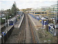
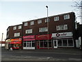
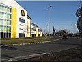
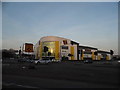
The lifestyle in Hawley (Hart) is shaped by its proximity to essential amenities. Residents have access to five retail outlets, including Lidl Blackwater, Aldi Blackwater, and Morrisons Daily Blackwater 24, ensuring daily shopping needs are met without long journeys. The railway stations—Blackwater, Camberley, and Sandhurst—offer practical links to nearby towns, while the nearby airports provide regional travel options. Although no parks or leisure facilities are listed, the area’s focus on retail and transport suggests a community prioritising convenience over expansive recreational spaces. The presence of multiple supermarkets and transport hubs indicates a pragmatic approach to daily life, with an emphasis on accessibility and efficiency for residents.
Amenities
Schools
Hawley (Hart) is served by Hawley Primary School, a state-funded institution with a ‘good’ Ofsted rating. This school caters to younger children, providing a foundation for local families. The absence of secondary schools or other educational institutions in the dataset means the area’s options for higher education are limited to nearby towns. For parents, the primary school’s rating indicates a satisfactory standard of teaching and facilities, though further research would be needed to assess broader educational opportunities. The single listed school suggests that families may need to look beyond Hawley (Hart) for secondary schooling, but the primary provision is reliable and meets basic needs.
| Rank | School | Type | Entry gender | Ages |
|---|
Explore more schools in this area
Go to Schools tabDemographics
The demographic profile of Hawley (Hart) is marked by a median age of 70, the highest in the dataset, suggesting a community predominantly composed of older adults. Home ownership is high, with 80% of residents owning their properties, reflecting a stable, long-term population. The data does not specify household composition or ethnic diversity, but the ‘total’ categories indicate a broad mix of accommodation types and household structures. The absence of detailed diversity metrics means the area’s cultural or social composition remains undefined in this dataset. For quality of life, the high home ownership rate implies a mature community with established social networks. However, the lack of specific data on deprivation or income levels means broader socioeconomic factors remain unexplored. Residents here are likely to prioritise stability over rapid change, with a focus on practical living over dynamic urban amenities.
Household Size
Accommodation Type
Tenure
Ethnic Group
Religion
Household Composition
Age
Household Deprivation
NS-SEC
Explore more demographic insights in this area
Go to Demographics tabPlanning
Planning Constraints
- Crime RiskPremium