Area Overview for Hawkhurst, Sandhurst & Benenden Ward
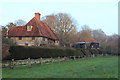
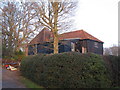
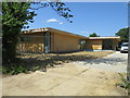
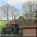
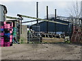
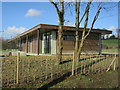
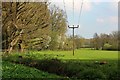
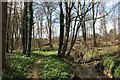
Photos of Hawkhurst, Sandhurst & Benenden Ward
Area Information
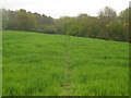
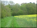
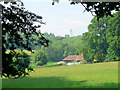
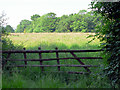
Living in Hawkhurst, Sandhurst & Benenden Ward offers a life defined by rural lanes and sculpted sandstone ridges. This electoral division spans 71.3 square kilometres within the Tunbridge Wells borough in Kent, placing it close to the border with East Sussex. The landscape is varied, featuring steep-sided valleys with gill streams and intersecting the High Weald Area of Outstanding Natural Beauty in the south-east of the region. Hawkhurst village itself lies approximately 12 miles south-east of Royal Tunbridge Wells. The settlement pattern is dispersed, linking small villages and hamlets through quiet countryside rather than urban sprawl. You will find undulating terrain dotted with historic country houses and ancient woods. The character of the area combines tranquil farmland with distinct village centres like Highgate, which features a covered colonnade, and The Moor, the oldest part of the parish. History permeates this setting, from its medieval administrative roots in the hundred of Great Barnfield to its recognition as a smugglers' resort in the 18th century. Daily life here revolves around a peaceful, rural ambience where sheep graze on steeper slopes and arable farming occurs on gentler ground. The night sky remains dark away from the lights of larger towns. Whether you seek the proximity to Bedgebury Forested Plateau or the quiet of scattered farmsteads, this ward provides a specific type of land-based living that avoids the density of nearby cities.
- Area Type
- District Borough Unitary Ward
- Area Size
- 71.3 km²
- Population
- 1750
- Population Density
- 1729 people/km²
Demographics
The community within Hawkhurst, Sandhurst & Benenden Ward is small and tightly knit, with a total population of just 1750 people. This low figure suggests a neighbourhood where residents know one another, supporting a traditional village culture rather than a transient lifestyle. The demographic profile is dominated by older residents, with a median age of 70 years. This indicates a population that has settled in the area for a significant period, likely looking for stability and low-key living rather than rapid demographic shifts. House ownership stands at 70 per cent, meaning the majority of households have purchased their homes outright or with a mortgage. This high level of ownership correlates with the overall slow pace of change and the stability provided by families who will remain in the area for decades. The ward encompasses three civil parishes – Hawkhurst, Sandhurst, and Benenden – which share this shared ownership and age profile. With such a small population density relative to the land size, the area functions more like several distinct hamlets than a single urban district. Shopping, socialising, and community activities centre around the historic villages rather than high streets. The demographic reality means the area is less suited to youth-oriented services and more aligned with retirement communities or families seeking a quiet adulthood in a historic setting. The absence of large industrial estates or major commercial hubs reinforces this social structure.
Household Size
Accommodation Type
Tenure
Ethnic Group
Religion
Household Composition
Age
Household Deprivation
NS-SEC
Explore more demographic insights in this area
Go to Demographics tabPlanning
Planning Constraints
- Flood RiskPremium
- Ramsar Wetland SitesPremium
- Area of Outstanding Natural BeautyPremium
- Protected Nature ReservePremium
- Protected WoodlandPremium
- Crime RiskPremium