Area Overview for Burley
Photos of Burley
Area Information
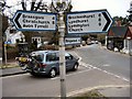
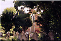
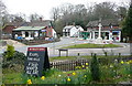
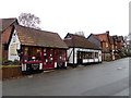
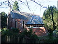
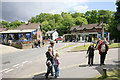
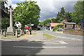
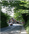
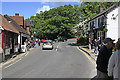
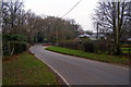
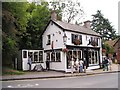
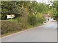
Burley is a civil parish located in the heart of the New Forest, covering an area of 45.6 km². This village has ancient origins dating back to Saxon times, with its name deriving from the words for fortified palace and clearing. It sits approximately 4 miles south-east of Ringwood, midway between the A31 and A35 roads. The population numbers around 1,400 residents who create a quiet, rural atmosphere surrounded by tree-clad slopes and open heathland. You will find the village centre features a low-lying shopping area with about 20 local shops, pubs like the Queen's Head, and tourist-oriented businesses. The landscape is defined by mature trees, paddocks, and fields, giving the impression of a wooded settlement within a larger nature reserve. Commoning traditions remain active here, with free-roaming ponies and cattle sharing the roads with car and bicycle traffic. A closed Holmsley railway station served the area until 1964, and today bus services provide the main link to Ringwood, Christchurch, and Southampton. You will feel a strong sense of history walking past the St John the Baptist Church and the central Parish Hall, which serve as community hubs. This location balances the openness of the New Forest with the amenities of a functional rural village.
- Area Type
- Parish
- Area Size
- 45.6 km²
- Population
- Not available
- Population Density
- Not available
Demographics
The community in Burley reflects a mature, settled population with a median age of 70 years. This age profile suggests the village attracts older residents rather than young families or students. The high proportion of elderly residents aligns with the slow pace of village life and the availability of local services. Home ownership stands at 77%, indicating a predominantly owner-occupied community where people have stayed long term. Most households consist of older couples or individuals living alone, fitting the village's character as a place for retirement or semi-retirement. The accommodation types are largely traditional brick houses built over the last 100 to 150 years, interspersed with thatched cottages and outlying limbs of development near Burley Street and Mill Lawn. While the data does not detail specific ethnicity or religion breakdowns, the village maintains a typical English rural demographic profile. You will find few listed buildings among the housing stock, as many homes are relatively modern constructions typical of New Forest expansions. The prevalence of owned homes and the older population means you are likely to deal with established neighbours who value the quiet environment. This stability offers a sense of security but lacks the demographic energy found in larger towns.
Household Size
Accommodation Type
Tenure
Ethnic Group
Religion
Household Composition
Age
Household Deprivation
NS-SEC
Explore more demographic insights in this area
Go to Demographics tabPlanning
Planning Constraints
- Flood RiskPremium
- Ramsar Wetland SitesPremium
- Area of Outstanding Natural BeautyPremium
- Protected Nature ReservePremium
- Protected WoodlandPremium