Area Overview for Fleet
Photos of Fleet
Area Information
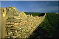
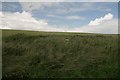
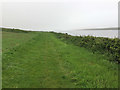
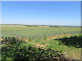
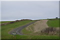
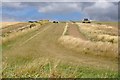
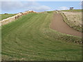
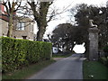
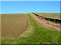
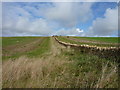
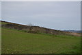
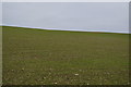
Living in Fleet offers a stark contrast to the modern urban sprawl found across much of England. This civil parish covers just 5.5 km², creating a tightly knit environment where residents know their surroundings intimately. You will find a community defined by quiet streets and a lack of industrial noise, as the area is situated far from major traffic arteries. The character of Fleet is shaped significantly by its status as a rural parish with significant environmental protections in place. Thirty-nine per cent of the land falls within an Area of Outstanding Natural Beauty, meaning new developments face strict planning constraints to preserve the landscape. Residents enjoy the peace of a low-density setting, though you should expect a slower pace of life compared to bustling town centres further away. Daily errands require careful planning, as the compact size does not imply a wide variety of large-scale retail or entertainment on-site. The majority of homes are occupied by those who have chosen to stay for decades, creating a stable atmosphere. For those seeking a haven away from city noise without the constraint of rural isolation, living in Fleet provides a distinct alternative. The area is defined by its natural features and its position as a small, self-contained parish where neighbourly relations remain strong.
- Area Type
- Parish
- Area Size
- 5.5 km²
- Population
- Not available
- Population Density
- Not available
Demographics
The community within Fleet reflects a settled population with a distinct age profile. The median age stands at 70 years, indicating that the majority of residents are older adults. This demographic skew suggests a neighbourhood where families with young children are less common, and retirees have dominated the population for some time. With 70% of homes currently owned outright, you will encounter very few rental properties. This high level of home ownership reinforces the image of a static community where long-term residents form the social fabric. The data does not specify the breakdown of household composition beyond the total requirement, but the high ownership rate strongly implies single-person households or empty-nester couples. Diversity in terms of ethnicity and religion is not detailed in the current records, which places the emphasis entirely on the age and tenure of the residents. You should expect a demographic environment where neighbours have likely lived in their properties for many years, fostering deep local knowledge and established routines. This profile makes Fleet attractive to those seeking retirement settlements or quiet accoutrements, but it may not suit buyers looking for the vibrancy of mixed-age neighbourhoods. The 70-year median age serves as a key indicator of the area's current life stage and future trajectory.
Household Size
Accommodation Type
Tenure
Ethnic Group
Religion
Household Composition
Age
Household Deprivation
NS-SEC
Explore more demographic insights in this area
Go to Demographics tabPlanning
Planning Constraints
- Flood RiskPremium
- Ramsar Wetland SitesPremium
- Area of Outstanding Natural BeautyPremium
- Protected Nature ReservePremium
- Protected WoodlandPremium