Area Overview for Eastleigh
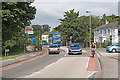
Photos of Eastleigh

Area Information
Eastleigh is a compact built-up area in England, spanning 11.2 km² with a population of 4,673. Its population density of 416 people per square kilometre suggests a tightly knit community, where daily life is shaped by proximity to amenities and local institutions. The area is notable for its older demographic, with a median age of 70, reflecting a community that values stability and familiarity. Eastleigh’s appeal lies in its practicality: it is well-served by rail links, including Eastleigh Railway Station and Southampton Airport Parkway, which connect residents to nearby cities and airports. The presence of multiple primary schools, all rated ‘good’ by Ofsted, adds to its family-friendly character. While the area is small, it offers a balance of residential tranquillity and access to essential services, making it a viable option for those seeking a low-maintenance lifestyle near transport hubs and local amenities.
- Area Type
- Built Up Area 250
- Area Size
- 11.2 km²
- Population
- 4673
- Population Density
- 416 people/km²
Eastleigh’s lifestyle is shaped by its proximity to practical amenities. Retail options include major chains like Tesco Eastleigh, Asda Chickenhall, and Lidl North, ensuring everyday shopping needs are met. The area’s rail links and nearby airports provide easy access to regional and national travel, while ferry terminals at Southampton offer maritime connectivity. A coach station adds to the transport network, supporting both local and longer-distance travel. The presence of multiple schools and the compact size of the area mean that essential services are within walking or short driving distance, contributing to a convenient, self-contained lifestyle. While the data does not detail parks or leisure facilities, the emphasis on transport and retail suggests a focus on functionality over leisure.
Amenities
Schools
Eastleigh is served by several primary schools, all of which hold a ‘good’ Ofsted rating. These include Stoke Park Infant School, Stoke Park Junior School, The Crescent Primary School, and Cherbourg Primary School, each providing quality education for younger children. The Bridge Education Centre, listed as an ‘other’ type, may cater to specific educational needs or adult learning. The concentration of primary schools suggests that families with young children have multiple options within the area, though secondary schooling is not detailed in the data. The consistent ‘good’ ratings indicate that parents can expect reliable education for their children, which is a key consideration for many homebuyers.
| Rank | School | Type | Entry gender | Ages |
|---|
Explore more schools in this area
Go to Schools tabDemographics
Eastleigh’s population is predominantly older, with a median age of 70, indicating a community where retirees and long-term residents form the majority. The home ownership rate stands at 70%, suggesting a stable housing market with a focus on owner-occupied properties. However, specific data on household composition, accommodation types, or ethnic diversity is not provided, limiting insight into the full demographic picture. The absence of detailed figures on deprivation or socioeconomic factors means the area’s quality of life cannot be assessed in context. What is clear is that Eastleigh’s population density and age profile suggest a mature, settled community, where daily life is likely centred on local amenities and familiar routines.