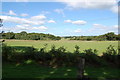
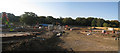
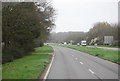
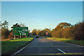
Area Overview for Hailsham North West Ward
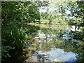
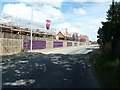
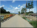
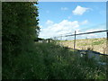
Photos of Hailsham North West Ward
Area Information
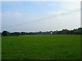
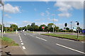
Living in Hailsham North West Ward offers a distinct residential experience within Wealden District Council in East Sussex. This electoral ward forms part of the Hailsham New Town electoral division, sharing governance with Hailsham South Ward and Hailsham West Ward under East Sussex County Council. The area covers 78.8 hectares, providing a defined boundary for this specific community unit. Prospective homebuyers find themselves in an area where planning decisions and local services are determined by this specific administrative structure. The ward represents a slice of the broader Hailsham urban fabric, yet it maintains its own identity as a designated ward for voting and representation purposes. Understanding the boundaries is essential for those navigating council services or planning restrictions in Hailsham North West Ward. The physical scale of the ward suggests a contained locality where neighbourhood dynamics likely remain manageable. Residents operate within a framework established by Wealden District Council, while also falling under the wider strategic oversight of East Sussex. This governance setup influences everything from local development projects to the rollout of public infrastructure. When considering living in Hailsham North West Ward, you are entering a space defined by these clear administrative lines and a specific geographical footprint.
- Area Type
- District Borough Unitary Ward
- Area Size
- 78.8 hectares
- Population
- Not available
- Population Density
- Not available
Demographics
The community in Hailsham North West Ward displays a clear demographic profile centred on older residents. You will find that the median age in this area stands at 70 years old. This figure indicates a population significantly skewed towards retirees and elderly residents rather than families with young children. The most common age range listed as total suggests a broad distribution across the older cohorts, but the central tendency remains firmly in the senior years. Home ownership stands at 80 percent within the ward. This high rate signifies a community where secrecy over property is rare, and residents likely have deep roots in the immediate location. Such stability often correlates with lower turnover rates and established neighbourhood networks. The household composition data is available as a total category, meaning specific breakdowns between single-person households or family units are not provided. Consequently, one cannot definitively state the ratio of single occupiers to families, though the high median age implies a significant number of single-person households. The predominant ethnic group, religion, and accommodation type data are aggregated as total categories, indicating a lack of granular detail on diversity or specific housing classifications beyond the general ownership metric.
Household Size
Accommodation Type
Tenure
Ethnic Group
Religion
Household Composition
Age
Household Deprivation
NS-SEC
Explore more demographic insights in this area
Go to Demographics tabPlanning
Planning Constraints
- Flood RiskPremium
- Ramsar Wetland SitesPremium
- Area of Outstanding Natural BeautyPremium
- Protected Nature ReservePremium
- Protected WoodlandPremium
- Crime RiskPremium