Area Overview for GU9 9QH
Photos of GU9 9QH
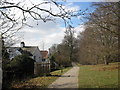
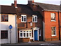
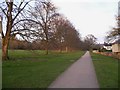
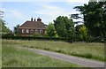
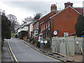
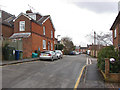
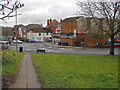
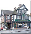
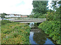
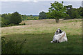

87 photos from this area
Area Information
Key information about the GU9 9QH including its size, population, and administrative classification.
- Area Type
- Postcode
- Area Size
- 8432 m²
- Population
- 1611
- Population Density
- 3733 people/km²
House Prices in GU9 9QH
25
Properties
£367,395
Average Sold Price
£85,000
Lowest Price
£730,000
Highest Price
Showing 25 properties
| Address | Type | Beds | Baths | Last Sale Price | Last Sale Date | |
|---|---|---|---|---|---|---|
| 34 Hale Road, Farnham, GU9 9QH | Semi-detached | 2 | 1 | £575,000 | Sep 2023 | |
| 40 Hale Road, Farnham, GU9 9QH | house | - | - | £730,000 | May 2023 | |
| 32 Hale Road, Farnham, GU9 9QH | Semi-detached | 3 | 2 | £562,500 | Jul 2022 | |
| 4 Hale Road, Farnham, GU9 9QH | house | - | - | £475,000 | Mar 2021 | |
| 12 Hale Road, Farnham, GU9 9QH | Semi-detached | 3 | 1 | £567,500 | Jan 2021 | |
| 24 Hale Road, Farnham, GU9 9QH | Semi-detached | 3 | 1 | £475,000 | Dec 2020 | |
| 16 Hale Road, Farnham, GU9 9QH | Semi-detached | 4 | 2 | £535,000 | Sep 2018 | |
| 14 Hale Road, Farnham, GU9 9QH | Semi-detached | 3 | 1 | £700,000 | Sep 2016 | |
| 22 Hale Road, Farnham, GU9 9QH | house | - | - | £288,000 | Sep 2011 | |
| 28 Hale Road, Farnham, GU9 9QH | Terraced | - | - | £325,000 | Nov 2007 |
Page 1 of 3
Energy Efficiency in GU9 9QH
Amenities
Schools
| Rank | School | Type | Entry gender | Ages |
|---|
Explore more schools in this area
Go to Schools tabDemographics
Household Size
Family (3-5 people)
most common
Accommodation Type
Houses
most common
Tenure
44
majority
Ethnic Group
White
most common
Religion
N/A
most common
Household Composition
N/A
most common
Age
47
median
Adults (30-64 years)
most common
Household Deprivation
N/A
with no deprivation
NS-SEC
35
in Lower managerial occupations
Explore more demographic insights in this area
Go to Demographics tabPlanning
Planning Constraints
- Flood RiskPremium
- Ramsar Wetland SitesPremium
- Area of Outstanding Natural BeautyPremium
- Protected Nature ReservePremium
- Protected WoodlandPremium