Area Overview for GU9 9ND
Photos of GU9 9ND
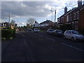
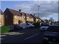
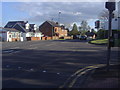
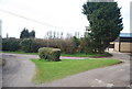
29 photos from this area
Area Information
Key information about the GU9 9ND including its size, population, and administrative classification.
- Area Type
- Postcode
- Area Size
- 18.7 hectares
- Population
- 1292
- Population Density
- 946 people/km²
House Prices in GU9 9ND
7
Properties
£233,250
Average Sold Price
£100,000
Lowest Price
£366,500
Highest Price
Showing 7 properties
| Address | Type | Beds | Baths | Last Sale Price | Last Sale Date | |
|---|---|---|---|---|---|---|
| 1 Monkton Lane, Farnham, GU9 9ND | Semi-detached | 3 | 2 | £366,500 | Dec 2020 | |
| Bleak House, 2 Monkton Lane, Farnham, GU9 9ND | house | - | - | £100,000 | Nov 2007 | |
| Tennis 69M From Farnham Rugby Union Football Club Ltd, Monkton Lane 29M From Wilkinson Way, Wilkinson Way, Farnham, GU9 9ND | Leisure | - | - | - | - | |
| Tennis 49M From 1 Monkton Lane 27M From Wilkinson Way, Wilkinson Way, Farnham, GU9 9ND | Leisure | - | - | - | - | |
| Tennis 50M From David Lloyd Leisure Ltd, Monkton Lane 36M From B3367, Monkton Lane, Farnham, GU9 9ND | Leisure | - | - | - | - | |
| Tennis 42M From David Lloyd Leisure Ltd, Monkton Lane 31M From B3367, Monkton Lane, Farnham, GU9 9ND | Leisure | - | - | - | - | |
| Monkton Farm, Monkton Lane, Farnham, GU9 9ND | Farm | - | - | - | - |
Energy Efficiency in GU9 9ND
Amenities
Schools
| Rank | School | Type | Entry gender | Ages |
|---|
Explore more schools in this area
Go to Schools tabDemographics
Household Size
Two person
most common
Accommodation Type
Houses
most common
Tenure
86
majority
Ethnic Group
White
most common
Religion
N/A
most common
Household Composition
N/A
most common
Age
47
median
Adults (30-64 years)
most common
Household Deprivation
N/A
with no deprivation
NS-SEC
46
in Lower managerial occupations
Explore more demographic insights in this area
Go to Demographics tabPlanning
Planning Constraints
- Flood RiskPremium
- Ramsar Wetland SitesPremium
- Area of Outstanding Natural BeautyPremium
- Protected Nature ReservePremium
- Protected WoodlandPremium