Area Overview for GU9 9JY
Photos of GU9 9JY
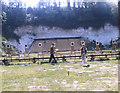
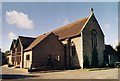
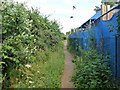

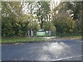

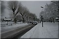
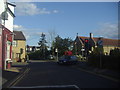
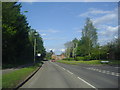
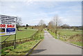
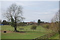
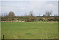
51 photos from this area
Area Information
Key information about the GU9 9JY including its size, population, and administrative classification.
- Area Type
- Postcode
- Area Size
- 1.4 hectares
- Population
- 1906
- Population Density
- 1021 people/km²
House Prices in GU9 9JY
33
Properties
£239,532
Average Sold Price
£112,500
Lowest Price
£387,500
Highest Price
Showing 33 properties
| Address | Type | Beds | Baths | Last Sale Price | Last Sale Date | |
|---|---|---|---|---|---|---|
| 12 Beech Tree Drive, Badshot Lea, Farnham, GU9 9JY | Maisonette | 2 | 1 | £275,000 | Feb 2025 | |
| 23 Beech Tree Drive, Badshot Lea, Farnham, GU9 9JY | Terraced | 3 | 1 | £387,500 | Dec 2022 | |
| 18 Beech Tree Drive, Badshot Lea, Farnham, GU9 9JY | Terraced | 3 | 1 | £340,000 | Jun 2022 | |
| 8 Beech Tree Drive, Badshot Lea, Farnham, GU9 9JY | house | - | - | £335,000 | Aug 2020 | |
| 4 Beech Tree Drive, Badshot Lea, Farnham, GU9 9JY | Semi-detached | 3 | 1 | £340,000 | Nov 2019 | |
| 10 Beech Tree Drive, Badshot Lea, Farnham, GU9 9JY | Maisonette | 1 | 1 | £232,000 | Aug 2016 | |
| 11 Beech Tree Drive, Badshot Lea, Farnham, GU9 9JY | Flat | - | - | £164,900 | Sep 2005 | |
| 6 Beech Tree Drive, Badshot Lea, Farnham, GU9 9JY | Semi-detached | 3 | 1 | £175,000 | May 2002 | |
| 17 Beech Tree Drive, Badshot Lea, Farnham, GU9 9JY | Terraced | 3 | 1 | £143,000 | Aug 2001 | |
| 2 Beech Tree Drive, Badshot Lea, Farnham, GU9 9JY | Semi-detached | - | - | £129,950 | Aug 2000 |
Page 1 of 4
Energy Efficiency in GU9 9JY
Amenities
Schools
| Rank | School | Type | Entry gender | Ages |
|---|
Explore more schools in this area
Go to Schools tabDemographics
Household Size
Two person
most common
Accommodation Type
Houses
most common
Tenure
76
majority
Ethnic Group
White
most common
Religion
N/A
most common
Household Composition
N/A
most common
Age
47
median
Adults (30-64 years)
most common
Household Deprivation
N/A
with no deprivation
NS-SEC
43
in Lower managerial occupations
Explore more demographic insights in this area
Go to Demographics tabPlanning
Planning Constraints
- Flood RiskPremium
- Ramsar Wetland SitesPremium
- Area of Outstanding Natural BeautyPremium
- Protected Nature ReservePremium
- Protected WoodlandPremium