Area Overview for GU9 8WY
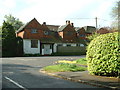
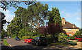
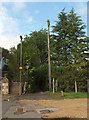
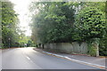
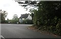
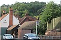
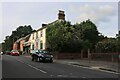
Photos of GU9 8WY


Area Information
Living in GU9 8WY offers a compact, residential experience in a small cluster of homes that cater to families and professionals seeking stability. With a population of 1,452, this area is characterised by its quiet, low-density environment, where most properties are owner-occupied. The median age of 47 suggests a mature community, with a strong presence of adults aged 30–64. Proximity to Farnham Railway Station and Aldershot Railway Station provides easy access to nearby towns, while nearby amenities like Tesco Ridgway and Sainsburys Farnham ensure daily needs are met. Digital connectivity is robust, with a broadband score of 91, supporting remote work and online activities. The area’s low flood risk and below-average crime rate of 76/100 further enhance its appeal as a safe, practical place to live. For those prioritising convenience over urban bustle, GU9 8WY balances accessibility with a sense of tranquillity.
- Area Type
- Postcode
- Area Size
- Not available
- Population
- 1452
- Population Density
- Not available
The property market in GU9 8WY is largely owner-occupied, with 86% of homes owned by residents rather than rented. This suggests a community of long-term residents who value stability and investment in their homes. The accommodation type is predominantly houses, which contrasts with areas dominated by flats or apartments. Given the small size of the area, the housing stock is limited in volume but likely varies in size and style to accommodate different household needs. For buyers, this means a focus on individual properties rather than a broad selection. The proximity to railway stations and amenities like Sainsburys Farnham adds practical value, making the area attractive to those prioritising convenience. However, the small scale of the area may limit options for those seeking larger or more specialised properties.
House Prices in GU9 8WY
No properties found in this postcode.
Energy Efficiency in GU9 8WY
Residents of GU9 8WY have access to a range of amenities within practical reach, enhancing daily life. Retail options include Tesco Ridgway, Sainsburys Farnham, and M&S Farnham BP, providing essential shopping and convenience. The nearby railway stations—Farnham, Aldershot, and Bentley—offer easy access to public transport, linking the area to larger towns and cities. Farnborough Airport adds another layer of connectivity for those requiring air travel. While the area’s small size means it lacks large-scale leisure facilities, the proximity to these amenities ensures a balance between local convenience and regional access. The presence of major retailers and transport hubs suggests a practical, functional lifestyle, ideal for those who prioritise efficiency over sprawling urban amenities.
Amenities
Schools
| Rank | School | Type | Entry gender | Ages |
|---|
Explore more schools in this area
Go to Schools tabDemographics
The community in GU9 8WY is predominantly composed of adults aged 30–64, with a median age of 47. This suggests a settled population, likely with established careers and family structures. Home ownership is high at 86%, indicating a strong preference for long-term residency over rental properties. The accommodation type is primarily houses, which aligns with the area’s residential character and the absence of high-density housing. The predominant ethnic group is White, reflecting a homogenous demographic profile. While no specific data on deprivation is provided, the high home ownership and low crime rate imply a stable, low-risk environment. This combination of factors supports a quality of life that prioritises security and community continuity over rapid change or diversity.
Household Size
Accommodation Type
Tenure
Ethnic Group
Religion
Household Composition
Age
Household Deprivation
NS-SEC
Explore more demographic insights in this area
Go to Demographics tabPlanning
Planning Constraints
- Flood RiskPremium
- Ramsar Wetland SitesPremium
- Area of Outstanding Natural BeautyPremium
- Protected Nature ReservePremium
- Protected WoodlandPremium